Planning a Nayarit weekend getaway? Two days are enough for a well-rounded trip if you choose the right route and don’t fill it with driving. Here are four weekend routes designed to leave early Saturday and return Sunday afternoon: two from Tepic (the north coast and the southern volcanoes), one from Puerto Vallarta (the Riviera Nayarit) and one from Guadalajara (the family beaches of Guayabitos and Chacala), each with an hour-by-hour itinerary, distances and an approximate 2026 budget.
If you have three days or more, the 3-, 5- and 7-day itineraries are in things to do in Nayarit, and the short list of essentials is in the 15 must-see places in Nayarit. Here the format is two days, one night away and short drives between stops.
The 4 Nayarit weekend getaway routes at a glance
| Route | Start | Approx. distance | Overnight | Profile |
|---|---|---|---|---|
| 1. North coast: San Blas, La Tovara and Mexcaltitán | Tepic | 250 km | San Blas | Mangroves, history, seafood |
| 2. Volcanoes and southern Pueblos Mágicos | Tepic or Guadalajara | 230 km from Tepic | Jala | Crater lake, volcano, archaeology |
| 3. Riviera Nayarit: Marietas, Sayulita and San Pancho | Puerto Vallarta | 130 km | Sayulita | Beach, surf, snorkeling |
| 4. Guayabitos and Chacala with kids | Guadalajara | 500 km round trip | Rincón de Guayabitos | Calm sea, families |
Road distances, rounded. Mind the clock: Bahía de Banderas (Sayulita, San Pancho, Punta de Mita) runs on Central time and the rest of Nayarit is one hour behind. The tables always use local time.
Route 1 — North coast from Tepic: San Blas, La Tovara and Mexcaltitán
Best for: travelers who want nature, history and the state’s most traditional seafood without Riviera prices. You’ll need a car. San Blas is about 60 km from Tepic (1 hour) on the Tepic–San Blas highway; from San Blas to Santiago Ixcuintla it’s about 46 km (50 minutes), plus 30 minutes more to the La Batanga boat landing.
| Time | Saturday: San Blas | Time | Sunday: Mexcaltitán |
|---|---|---|---|
| 8:00 | Leave Tepic on the San Blas highway | 7:30 | Drive from San Blas to Santiago Ixcuintla |
| 9:00 | Breakfast on the San Blas plaza | 8:30 | Breakfast in Santiago, then on to La Batanga |
| 10:00 | Boat ride through the mangrove channels of La Tovara (2.5–3 h), a swim in the spring and the crocodile sanctuary | 10:00 | 15–20 min boat ride to the island of Mexcaltitán |
| 13:30 | Lunch on Matanchén Bay or Las Islitas: pescado zarandeado (grilled butterflied fish) and banana bread | 10:30 | Plaza, San Pedro y San Pablo church and the Museo del Origen |
| 16:00 | Cerro de La Contaduría: remains of the colonial port and a lookout | 13:00 | Lunch: shrimp tamales, shrimp meatballs or tlaxtihuil |
| 18:00 | Sunset at El Borrego beach (bring repellent) | 15:00 | Boat back and drive to Tepic (approx. 2 h) |
| 20:00 | Dinner and overnight in San Blas | 17:30 | Back in Tepic |
- Best season: November to April, with fewer sand flies and less humidity. From July to October, Mexcaltitán floods and its streets are traveled by canoe: its most famous image, but it’s hot and rains in the afternoon.
- Cash: the La Tovara boats (approx. $200–300 MXN per person in 2026) and the Mexcaltitán boats are paid in cash.
- More time: swap Saturday afternoon for El Cora waterfall or add the beaches south of San Blas; see the beaches of San Blas.
Route 2 — Volcanoes and southern Pueblos Mágicos: crater lake, Jala, Ceboruco and Los Toriles
Best for: volcanic landscapes, stone-built towns and home-style cooking. From Tepic, drive to the Santa María del Oro crater lake (about 53 km, 1 hour), continue to Jala (about 60 km, 1 hour) and on Sunday head down to Ixtlán del Río (15 km). From Guadalajara, do it in reverse: Guadalajara–Ixtlán is about 127 km (1 h 45 min) on Highway 15D. Jala and Ixtlán are Pueblos Mágicos, Mexico’s official “Magical Towns”.
| Time | Saturday: crater lake and Jala | Time | Sunday: Ceboruco and Ixtlán |
|---|---|---|---|
| 8:00 | Leave Tepic on the Guadalajara highway and take the Santa María del Oro turnoff | 7:30 | Drive up the Ceboruco volcano (2,280 m) from Jala |
| 9:00 | Kayak or swim in the crater lake (approx. 2.5 km across) | 8:30 | Short walk to the fumaroles and crater lookouts |
| 13:00 | Lunch on the shore: fried fish bites (chicharrón de pescado) and frog legs | 11:00 | Optional: Jomulco waterfall, 4 km from Jala (2 km walk along the creek) |
| 15:00 | Drive to Jala (approx. 1 h) | 12:30 | Los Toriles archaeological site in Ixtlán del Río (open 9:00–17:00) |
| 16:30 | Downtown Jala and the Basilica of Nuestra Señora de la Asunción | 14:30 | Pollo a la plaza (plaza-style chicken) under the Ixtlán arcades |
| 19:00 | Dinner and overnight in Jala | 16:00 | Back to Tepic (approx. 82 km, 1 h 15 min) or Guadalajara (1 h 45 min) |
- The Ceboruco road climbs from Jala to the antennas; a high-clearance vehicle and clear skies (November to April) are best. The volcano is monitored: check Nayarit Civil Protection notices before going up. More in volcanoes of Nayarit.
- Hot-spring variant: swap Sunday for Amatlán de Cañas and its 37–40 °C springs, about 56 km from Ixtlán (1 hour).
Route 3 — Riviera Nayarit from Puerto Vallarta: Marietas, Sayulita and San Pancho
Best for: flying into Puerto Vallarta (PVR) and seeing the best of the coast in two days, even without a car. From the airport to Punta de Mita is about 45 km (55 minutes); Punta de Mita to Sayulita, 16 km (25 minutes); Sayulita to San Pancho, 8 km.
| Time | Saturday: Punta de Mita and Marietas | Time | Sunday: Sayulita and San Pancho |
|---|---|---|---|
| 7:30 | Leave PVR or Nuevo Vallarta for Punta de Mita | 7:30 | Surf lesson in Sayulita (1.5–2 h, board included) |
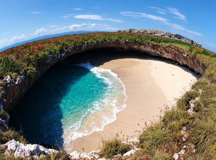
| 9:00 | Islas Marietas tour from El Anclote (3–4 h): snorkeling and, with a permit, the Hidden Beach | 10:30 | Breakfast and a stroll around the plaza |
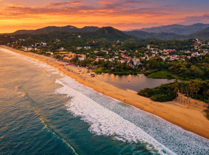
| 13:30 | Lunch on El Anclote beach | 12:00 | San Pancho: beach, Avenida Tercer Mundo and galleries |
| 15:30 | Transfer to Sayulita and check in | 14:00 | Lunch in San Pancho |
| 17:00 | Walk to Playa de los Muertos and the plaza | 16:00 | Head back toward Bucerías (approx. 25 km, 30 min) |
| 18:30 | Sunset on the main beach | 16:45 | Bucerías beach and boardwalk at sunset |
| 20:00 | Dinner and overnight in Sayulita | 19:00 | To the airport (approx. 18 km, 25 min) |
- Book Marietas ahead: the Hidden Beach opens Wednesday to Sunday, with a limited daily quota and a 30-minute stay; the CONANP conservation wristband is paid separately from the tour.
- With an extra day, add La Cruz de Huanacaxtle, whose Sunday market runs 10:00–14:00 from November to April.
- From Guadalajara the route works the same: Sayulita is about 265–300 km away (3 h–3 h 30 min) via the Jala–Puerto Vallarta highway.
Route 4 — From Guadalajara: Guayabitos and Chacala with kids
Best for: families with young children who want a wave-free sea and bungalow prices. From Guadalajara to Rincón de Guayabitos it’s about 235 km (3 h–3 h 30 min); from Guayabitos to Chacala, 29 km (30 minutes). On this route you set your watch back an hour when you enter Nayarit: leave Guadalajara at 7:00 and you’ll arrive around 9:30 local time.
| Local time | Saturday: Guayabitos | Local time | Sunday: Chacala |
|---|---|---|---|
| 9:30 | Arrive in Rincón de Guayabitos and check into a bungalow | 8:00 | Drive to Chacala |
| 10:30 | Boat to Isla del Coral and snorkeling | 8:45 | Breakfast overlooking the bay |
| 13:30 | Beach lunch: pescado zarandeado | 9:30 | Sheltered beach and the little cove at the far end, perfect for small kids |
| 16:00 | Calm beach time or a walk to Los Ayala, the next cove | 12:30 | Lunch at the seafood palapas |
| 19:00 | Dinner and overnight in Guayabitos | 14:00 | Drive back to Guadalajara (arrive around 18:30 Central time) |
- From December to March, boats leave Chacala and Guayabitos to see humpback whales; read our whale-watching guide.
- More calm beaches on this stretch in Lo de Marcos, Chacala and Platanitos.
Approximate budget per route (2026)
Per-person figures for two days and one night at a mid-range level, sharing a room between two (on route 4, bungalow and car shared among four). They include lodging, meals, main activities and a share of gas and tolls. Reference exchange rate: 17.5 MXN per USD.
| Route | Lodging (per night, room) | Key activities | Total per person |
|---|---|---|---|
| 1. North coast | $700–1,600 MXN in San Blas | La Tovara boat, Mexcaltitán boat | Approx. $1,500–2,800 MXN (85–160 USD) |
| 2. Volcanoes and south | $700–1,500 MXN in Jala | Kayaking on the lake, Los Toriles | Approx. $1,500–2,800 MXN (85–160 USD) |
| 3. Riviera Nayarit | $2,000–4,500 MXN in Sayulita | Marietas tour ($1,200–1,900 MXN) + surf lesson ($1,000–1,600 MXN) | Approx. $4,500–8,000 MXN (260–460 USD) |
| 4. Guayabitos and Chacala | $1,200–2,000 MXN bungalow for four | Isla del Coral boat; round-trip tolls approx. $2,760 MXN per car | Approx. $2,000–3,000 MXN (115–170 USD) |
In high season (December to April, Holy Week and long weekends) lodging rises 30–50%. The full cost breakdown is in how much a trip to Nayarit costs.
Before you go
Start early on Saturday: boats, surf and volcanoes are all best in the morning. Book Saturday night ahead in high season and on long weekends, carry cash, and drive in daylight away from the coast. Also read our Nayarit travel tips and the routes in how to get to Nayarit.
Frequently asked questions
What can I do on a weekend in Nayarit?
From Tepic, San Blas with La Tovara and Mexcaltitán, or the Santa María del Oro crater lake, Jala and the Ceboruco volcano. From Puerto Vallarta, the Islas Marietas, Sayulita and San Pancho. From Guadalajara, Guayabitos and Chacala with kids.
How much does a weekend in Nayarit cost?
In 2026, approx. $1,500–2,800 MXN (85–160 USD) per person on the inland and north-coast routes, and $4,500–8,000 MXN (260–460 USD) in the Riviera Nayarit with a Marietas tour and surf lesson, mid-range.
Can I do a Nayarit weekend without a car?
Yes in the Riviera Nayarit: the Compostela bus links Puerto Vallarta, Bucerías, Sayulita and San Pancho. For San Blas, Mexcaltitán, Jala or the Ceboruco, a car is the practical choice.
Which Nayarit beach is closest to Guadalajara?
Rincón de Guayabitos and the beaches of Jaltemba Bay are about 235 km away (3 h–3 h 30 min); Bucerías and Sayulita about 265–300 km via the Jala–Puerto Vallarta highway.
When is the best time for a Nayarit getaway?
November to April: dry weather, calm seas and good roads. From July to October there are afternoon rains, but prices drop and waterfalls run fuller.
Area map
- 1San Blas (pier) Route 1: overnight in San Blas, La Tovara and Matanchén; approx. 60 km from Tepic.21.5408, -105.2914 · Open in Google Maps
- 2Mexcaltitán Route 1: island in the lagoon; 15–20 min boat from La Batanga.21.9057, -105.4752 · Open in Google Maps
- 3Santa María del Oro crater lake Route 2: flooded crater approx. 2.5 km across; 53 km from Tepic.21.3694, -104.5689 · Open in Google Maps
- 4Ceboruco volcano (crater) Route 2: active 2,280 m volcano; drive up from Jala.21.1252, -104.5076 · Open in Google Maps
- 5Sayulita Route 3: overnight in Sayulita, surf and San Pancho; 50 min from PVR airport.20.8689, -105.4407 · Open in Google Maps
- 6Rincón de Guayabitos Route 4: wave-free sea and boat to Isla del Coral; approx. 235 km from Guadalajara.21.02585, -105.26489 · Open in Google Maps