The San Blas beaches show the other side of the Nayarit coast: long stretches of sand without big hotels, fishermen’s enramadas (palm-roofed beach eateries) and mangroves just minutes away. From north to south, the municipality’s shoreline runs from El Borrego, right next to town, to Matanchén Bay and Las Islitas, then on to Aticama, Los Cocos and Santa Cruz de Miramar. There are beaches for swimming with kids, a summer wave famous among longboarders and corners where almost nobody goes.
San Blas is one of the most accessible Pueblos Mágicos (Mexico’s official “Magical Towns”) from Tepic, about an hour away by highway. This guide compares every beach in one table (waves, services and what each is good for), explains how to deal with the jejenes (sand flies), when to go and how to get there. For the history of the port, the La Contaduría fort and everything else to do in the municipality, see our San Blas guide.
San Blas beaches at a glance
| Beach | From downtown San Blas | Waves | Services | Best for |
|---|---|---|---|---|
| El Borrego | 1–2 km | Moderate; big summer wave | Enramadas, board rental | Sunsets, surfing, walks |
| Playa del Rey (Isla del Rey) | 5–10 min boat ride | Moderate to strong | None | Solitude, walks; Wixárika sacred site |
| Las Islitas | 7 km | Gentle; long wave with south swell | Enramadas | Families, longboarding |
| Matanchén Bay | 8–10 km | Gentle | Enramadas, boat landing for La Tovara | Swimming, eating, pairing with the mangroves |
| Aticama | approx. 15 km | Calm | Seafood fondas | Oysters and seaside meals |
| Los Cocos and Santa Cruz de Miramar | 20–25 km | Moderate | Few; fondas in Santa Cruz | Near-empty beach, fishing village |
| Platanitos (Compostela municipality) | approx. 35 km | Moderate | Seafood palapas | Lunch, turtle camp |
Distances are approximate road distances (2026); travel times depend on weekend traffic.
El Borrego Beach
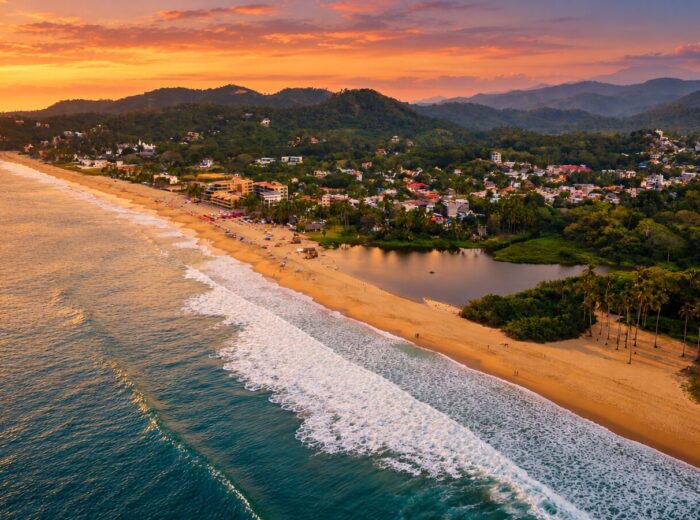
San Blas’s town beach: about three kilometers of golden sand, moderate waves and basic services, a few minutes from downtown. Its sunsets are the big draw. Enramadas serve pescado zarandeado (chili-rubbed fish grilled over wood) and steamed shrimp, and you can rent boards. El Borrego is also home to Stoner’s Point, where a long, powerful summer wave forms for experienced surfers. To swim, stay in front of the enramadas and skip big-swell days.
Playa del Rey on Isla del Rey
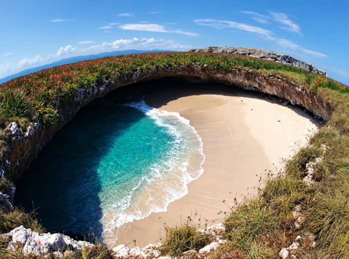
Across the estuary from the pier, Isla del Rey has an open Pacific beach that is almost always empty. Fishermen’s boats cross from the San Blas pier in 5–10 minutes. There are no services: bring water and shade, and be back in time for the last boat. Off the island rises the Piedra Blanca, home of Tatei Haramara, the Mother Sea of the Wixárika people; visit respectfully and never move offerings. We tell the story in Tatei Haramara: the Wixárika legend of the sea.
Las Islitas and the long wave of Matanchén
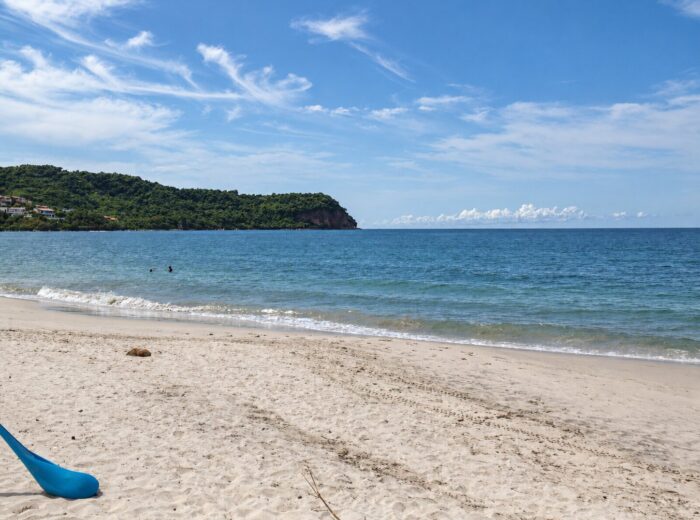
Las Islitas sits at the northern end of Matanchén Bay, about 7 km from town. Its rock formations create small coves and pools, the sea is gentle most of the year and family-run enramadas serve fish fresh off the boat and the area’s traditional pan de plátano (banana bread).
Its fame comes from the summer wave: when a south swell arrives, the Las Islitas wave can run for more than a kilometer, and Guinness once recorded it as the longest in the world. It is a slow, friendly wave, perfect for longboards. To discover other breaks in the state, see where to surf in Nayarit.
Matanchén Bay
A wide bay with warm water and fine sand, ideal for a family beach day. The small village of Matanchén has enramadas on the sand and the boat landing where launches leave for La Tovara, a freshwater spring reached through mangrove tunnels. The easy plan is to do both in one day: boat ride in the morning, beach and lunch in the afternoon. Read the La Tovara route before you go.
Aticama
A fishing village on the coastal road south of Matanchén. Its beach is calm and uncrowded, perfect for a meal by the sea. Aticama is known for its oysters, served fresh at the village fondas (small family-run eateries); ask for the catch of the day.
Los Cocos and Santa Cruz de Miramar
Farther south, between Aticama and Santa Cruz de Miramar, the coast turns greener and almost undeveloped. Los Cocos is ideal if you want an untouched beach and quiet sunsets. Santa Cruz de Miramar, about 25 km from downtown San Blas, is a fishing village with palapas serving good, inexpensive food. From here a road climbs to Tecuitata and El Cora, with waterfalls and pools to cool off in (see the El Cora waterfall route).
Platanitos, the neighbor in Compostela
Platanitos technically belongs to the municipality of Compostela, but many travelers add it to a San Blas beach run. It is a small bay, about 400 meters long, with a row of seafood palapas, a lookout above the road and a turtle camp in season. We cover it in detail in Lo de Marcos, Chacala and Platanitos.
Jejenes and the best season
Jejenes are tiny biting midges that live in the mangroves and damp sand. They bite mostly at dawn and dusk and are worst from July to October, during the rainy season. They won’t ruin your trip if you come prepared:
- Apply repellent with DEET or picaridin from late afternoon, including ankles and the back of your neck.
- At sunset, switch to long sleeves and light pants.
- Choose lodging with screens or air conditioning.
- Look for breezy hours: with wind they almost disappear.
| Season | Months | Sea | Jejenes | What to expect |
|---|---|---|---|---|
| Dry | November – April | Calm, clear water | Few | Best time for beaches, migratory birds and La Tovara |
| Hot | May – June | South swells begin | Increasing | Humid heat, uncrowded beaches |
| Rainy | July – October | Long wave at Las Islitas and El Borrego | Many | Surf season, afternoon rain and hurricane risk |
For detailed weather, see Nayarit weather month by month.
How to get to the San Blas beaches
| From | Approx. distance | Approx. time | Route |
|---|---|---|---|
| Tepic | 65–70 km | 1 h | Tepic–San Blas highway |
| Puerto Vallarta | 165 km | 2 h 45 min | Highway 200 and coastal road |
| Guadalajara | 260 km | 3 h 30 min | Highway 15D via Tepic |
A car is the easiest way to hop between beaches: the coastal road links San Blas with Matanchén, Las Islitas, Aticama and Santa Cruz de Miramar. Without a car, there are taxis in downtown San Blas; agree on the fare before getting in and arrange a fixed pickup time, because few cabs pass by the southern beaches.
More to do nearby
- La Tovara: a boat ride through the mangroves to a spring you can swim in.
- Cebadilla volcano: a volcanic cone of about 860 m between Tepic and the coast; read our Cebadilla volcano guide.
- Isla Isabel: the seabird sanctuary reached by boat from San Blas; see our Isla Isabel guide.
- More beaches across the state: compare them in the best beaches in Nayarit.
Tips for your visit
- Bring cash: not every beach has an ATM and many enramadas don’t take cards.
- Try the pan de plátano, a local specialty.
- Follow the flags and the fishermen’s advice about currents.
- Leave no trash: these beaches are nesting grounds for turtles and birds.
San Blas proves that Nayarit is much more than the Riviera. This is a place to come and breathe in the sea, history and silence.
Frequently asked questions
What is the best beach in San Blas?
It depends on your plans: Las Islitas and Matanchén for family swimming and lunch, El Borrego for sunsets and surfing, and Los Cocos for a nearly empty beach.
Can you swim at the San Blas beaches?
Yes. Las Islitas and Matanchén Bay have the gentlest water. El Borrego and Playa del Rey get more surf: stay close to shore and avoid swell days.
When are the jejenes (sand flies) worst in San Blas?
They are around at dawn and dusk all year, but peak from July to October in the rainy season. From November to April there are far fewer.
Where is the long wave in San Blas?
At Las Islitas, in Matanchén Bay. With summer south swells it can run over a kilometer, and Guinness once recorded it as the longest wave in the world.
How long does it take from Tepic to the San Blas beaches?
About an hour on the Tepic–San Blas highway (65–70 km). Las Islitas and Matanchén are another 10–15 minutes from downtown San Blas.
Is Platanitos part of San Blas?
No, Platanitos belongs to the municipality of Compostela, although it sits on the same coastal road, about 35 km from San Blas.
Area map
- 1El Borrego Beach San Blas town beach: sunsets and Stoner's Point.21.5281, -105.2835 · Open in Google Maps
- 2Playa del Rey (Isla del Rey) Open beach across the estuary by boat (5–10 min).21.5322, -105.297 · Open in Google Maps
- 3Las Islitas Coves at the north end of Matanchén Bay; long summer wave.21.515, -105.256 · Open in Google Maps
- 4Matanchén Village with enramadas and the boat landing for La Tovara.21.5312, -105.247 · Open in Google Maps
- 5Aticama Quiet fishing village known for its oysters.21.4852, -105.1958 · Open in Google Maps
- 6Santa Cruz de Miramar Fishing village; access to Los Cocos and El Cora.21.4326, -105.1962 · Open in Google Maps