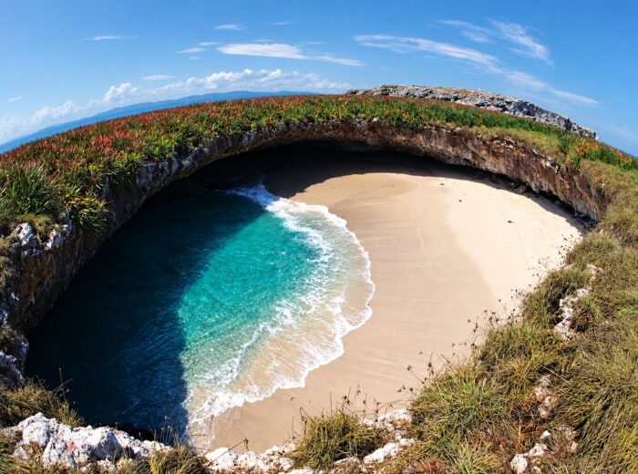
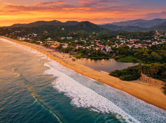
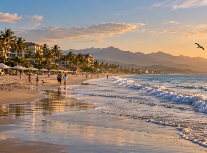
North of Sayulita, the Riviera Nayarit slows down. Between Lo de Marcos and Platanitos there are about 70 kilometers of Highway 200 lined with wide beaches, sheltered bays and fishing villages where lunch is still served under a palapa (a thatched-roof beach restaurant) with your feet in the sand. None of these beaches has Sayulita’s fame or Nuevo Vallarta’s resorts, and that is exactly why they work so well for travelers who want calm water, fair prices and no crowds.
This guide runs along the northern coast from south to north. For each beach you will find what the sea is like, what services exist, how to get there from Puerto Vallarta and from Tepic, and who it suits. At the end there is a comparison table, a one-day route and the best time to come.
One practical note: all of these beaches sit in the municipality of Compostela (except Lo de Marcos, which belongs to Bahía de Banderas), and they are all strung along the same Federal Highway 200. Second-class Compostela–Pacífico buses leave Puerto Vallarta’s bus station every 20 to 30 minutes and stop at every junction, so you can do this whole stretch without a car.
Quick facts
- What it is: about 70 km of coast along Highway 200, from Lo de Marcos to Platanitos: quiet beaches, no big resorts.
- For families: Rincón de Guayabitos (very calm sea) and Chacala (sheltered, swimmable bay).
- From Puerto Vallarta airport: Lo de Marcos 52 km (1 h), Guayabitos 70 km (1 h 15), Chacala 105 km (1 h 50), Platanitos 125 km (2 h 15).
- Without a car: Compostela–Pacífico bus from the Puerto Vallarta bus station every 20–30 min, approx. $60–80 MXN.
- Best time: November to April: calm sea, clear water and whales; July to October, turtle releases.
Lo de Marcos: the wide, family-friendly beach
Lo de Marcos is the first village north of San Pancho and the quietest on that stretch. Its main beach is just over two kilometers long, wide, with pale sand and a gentle slope. In winter the sea is usually fine for adults and older kids; in summer there are days with strong surf, so check the flags before going in. At the northern end a small estuary attracts herons and other birds.
The town has around 2,000 residents, and from November to March it nearly doubles as Canadian and American retirees arrive in RVs or rent by the month. There is no nightlife and no big hotels; lodging is bungalows and rental homes from approx. $1,200 MXN / 65 USD per night in 2026.
Las Minitas and Los Venados
South of town, following the beach road, are two small coves. Playa Los Venados can be reached by car or on a 20-minute walk along a dirt track; it is a short sandy beach with seasonal palapas and calmer water than the main beach. Las Minitas is smaller still and reached by boat or by swimming over from Los Venados: a rocky cove that is ideal for snorkeling when the water is clear, from November to May.
Getting there: 52 km from Puerto Vallarta airport (about 1 hour on Highway 200) and roughly 115 km from Tepic (1 h 45 min). The Compostela bus from Vallarta takes 60 to 75 minutes and costs approx. $60–80 MXN in 2026. Best for: families with kids, couples looking for quiet, and long-stay travelers.
Lo de Marcos also holds Blue Flag certification for the 2025-2026 season, one of only three Nayarit beaches recognized for water quality, safety and services.
Rincón de Guayabitos and Los Ayala: the natural swimming pool
Twelve kilometers north is Jaltemba Bay, home to Rincón de Guayabitos, La Peñita and Los Ayala. This is the most popular beach in the area for families from Guadalajara and Tepic: the sea is so flat it is nicknamed “the world’s largest natural swimming pool”, there are boat trips to Isla del Coral, vendors selling pescado zarandeado (butterflied fish grilled over mangrove wood) on the sand, and dozens of hotels and bungalows. Los Ayala is the smaller, slightly quieter version in the next cove.
If you want full services and safe water for children, this is your beach. We have a full guide in Guayabitos, the world’s largest natural swimming pool. It is 70 km from Puerto Vallarta and 96 km from Tepic.
El Monteón and Punta Raza: the hidden beach
Six kilometers past the Los Ayala turnoff, right on Highway 200, is the village of El Monteón. From its main street a dirt road runs about two kilometers to Punta Raza, a long, nearly untouched beach with turquoise water and a fringe of palms. There are no palapas or permanent services, just the occasional seasonal shelter, so bring water and shade.
The sea here is open and has surf: good for walking, photos and wading at the edge, not for swimming with children. A vehicle with decent clearance is recommended; on foot from El Monteón it is about two hours. Best for: couples and travelers who want an empty beach half an hour from Guayabitos.
Chacala: the sheltered bay
Chacala is a fishing village on a horseshoe-shaped bay, 13 km west of Las Varas. The main beach is close to a kilometer long, protected by two rocky points, and has calm water nearly year-round: it is one of the most swimmable beaches in Nayarit, with seafood palapas along the shore and pangas (small open fishing boats) that go out fishing or whale watching from December to March. At the right-hand end, after a short trail, there is a tiny cove with almost no waves, perfect for toddlers.
The bay has three more beaches: Chacalilla (small and calm, inside a private development with restricted access), La Caleta (a left-hand surf break reached by boat or trail) and Las Cuevas, with heavy surf and 4×4 access.
Techos de México: community lodging
Chacala is known for the Techos de México program, launched in 1995 so that local families could build rooms to rent to visitors. Today six houses take part (Casa Aurora, Casa María, Casa Concha and Casa Yiya among them), offering simple rooms, some with a kitchen and patio, from approx. $600 MXN / 35 USD per night in 2026. The rest of the offer is boutique hotels and beachfront homes from approx. $2,500 MXN / 135 USD.
Altavista petroglyphs
About 10 km inland from Chacala is the Altavista archaeological site: a jungle trail along a creek with more than 50 petroglyphs carved into boulders, some over 2,000 years old, and a natural pool known as the Pila del Rey (King’s Basin). Access is by dirt road and a 20-minute walk; go with a local guide, since the entrance is unmarked.
Getting there: approx. 105 km from Puerto Vallarta airport (1 h 50 min) and 80 km from Tepic (1 h 20 min). By Compostela bus to Las Varas, then a taxi or shared van (12 minutes). Best for: families with young children, couples, and anyone who wants a beach village without noise.
Platanitos: the bay of palapas
Platanitos is the last beach in Compostela before you enter the municipality of San Blas. It is a small bay, about 400 meters across, with fine sand, warm water and a row of seafood palapas that take up nearly the entire shoreline. People come here to eat shrimp, pescado zarandeado and oysters with the sea three meters away. The surf is moderate; on calm days the swimming is good, but when a swell is running it is better to stay near the edge.
Arriving by road from Zacualpan you pass a natural lookout over the whole bay, the mandatory photo stop. North of the rocks, long open beaches follow where hawksbill and olive ridley turtles nest from July to December.
Getting there: about 69 km from Tepic (1 h 10 min on Highway 200 via Las Varas and Zacualpan) and approx. 125 km from Puerto Vallarta (2 h 15 min). In 2026 construction began on the Las Varas–Platanitos highway, which will cut travel time from the southern coast. Best for: groups and families out for a seafood day, and Tepic residents on a weekend escape.
Northern coast beaches compared
| Beach | Sea | Services | From PVR | From Tepic | Best for |
|---|---|---|---|---|---|
| Lo de Marcos | Swimmable in winter, surf in summer | Palapas, bungalows, RV park, shops | 52 km / 1 h | 115 km / 1 h 45 | Families, long stays |
| Los Venados / Las Minitas | Sheltered, snorkeling | Seasonal palapas | 55 km / 1 h 10 | 118 km / 1 h 50 | Snorkel, couples |
| Guayabitos / Los Ayala | Very calm | Hotels, restaurants, boats | 70 km / 1 h 15 | 96 km / 1 h 20 | Families, services |
| Punta Raza | Open, surf | None | 78 km / 1 h 30 | 90 km / 1 h 30 | Solitude, photos |
| Chacala | Sheltered bay, swimmable | Palapas, community lodging, boutique | 105 km / 1 h 50 | 80 km / 1 h 20 | Kids, couples |
| Platanitos | Moderate | Seafood palapas, lookout | 125 km / 2 h 15 | 69 km / 1 h 10 | Eating, groups |
A one-day drive along the northern coast
Driving from Puerto Vallarta or Sayulita you can see the essentials in one long day. Leave early.
- 8:00 – Lo de Marcos. Breakfast in town and a walk along the main beach to the estuary.
- 10:30 – Los Ayala. A short stop to see Jaltemba Bay from its smaller cove. If you would rather have an empty beach, swap it for Punta Raza.
- 12:30 – Chacala. Swim in the bay and eat seafood at a palapa. This is the best swimming stop of the day.
- 15:30 – Platanitos. Climb to the lookout for the photo, then head down to the bay for a late ceviche, or stay for sunset if you are sleeping in Chacala.
From Tepic, reverse the order: Platanitos first, Chacala to swim and eat, and finish in Guayabitos or Lo de Marcos.
See how to get to Nayarit for transport options.
Best time to visit
- November to April: dry season, calmer sea and clear water for snorkeling. This is the best time and the busiest; book ahead for December and Easter week. It overlaps with whale watching from Chacala and Guayabitos.
- May and June: hot, but few people and low prices. A good window for Chacala and Platanitos.
- July to October: afternoon rain, stronger surf on open beaches and high humidity. This is sea turtle release season in Platanitos and Lo de Marcos; bring repellent and skip the dirt road to Punta Raza after heavy rain.
To keep exploring north, the highway continues to the beaches of San Blas; to the south, Sayulita and the rest of the Riviera Nayarit are waiting.
Frequently asked questions
Can you swim at Lo de Marcos?
Yes, especially from November to May, when the sea is usually calm. In summer there are days with strong surf and currents; check the flags, and with small children prefer Los Venados or Chacala.
Which beach north of Sayulita is calmest for kids?
Chacala and Rincón de Guayabitos both have sheltered bays with minimal waves. Chacala is smaller and quieter; Guayabitos has more services.
How do I get to Chacala without a car?
Take the Compostela–Pacífico bus from Puerto Vallarta’s bus station or from Tepic to Las Varas, then a taxi or shared van to Chacala (13 km, about 12 minutes).
What is Techos de México in Chacala?
A community lodging program that began in 1995: local families rent simple rooms in their homes. It is the most affordable option and a direct way to support the village.
Area map
- 1Lo de Marcos Beach Wide family beach in Bahía de Banderas.20.96219, -105.3563 · Open in Google Maps
- 2Las Minitas Beach Snorkeling cove south of Lo de Marcos.20.95448, -105.36586 · Open in Google Maps
- 3Los Ayala Small, quiet cove next to Guayabitos.21.02522, -105.28535 · Open in Google Maps
- 4Punta Raza Beach (El Monteón) Secluded beach reached from El Monteón.21.01939, -105.3148 · Open in Google Maps
- 5Chacala Sheltered bay in Compostela with a fishing village.21.16668, -105.22551 · Open in Google Maps
- 6Altavista petroglyphs Rock art by the Las Piletas stream, near Chacala.21.0893, -105.1686 · Open in Google Maps