Looking for things to do in Nayarit? In short: surf and snorkel on the Riviera Nayarit, mangroves and birds in San Blas, an island town you explore by boat in Mexcaltitán, volcanoes and Pueblos Mágicos (Mexico’s official “Magical Towns”) in the south, living Cora and Wixárika (Huichol) culture in the sierra, and nearly empty beaches up north. The state is compact (Tepic, the capital, is 1–2 hours from almost everything), so in a week you can combine sea, mountains and city without spending the trip in the car.
This guide organizes 25 places and experiences by region, with distances from Tepic or from Puerto Vallarta airport (PVR), so you can plan around where you sleep. If you only want the short list of essentials, see the 15 must-see places in Nayarit in 2026.
Things to do in Nayarit: the 6 regions at a glance
| Region | Places and experiences | Where to stay | Reference distance |
|---|---|---|---|
| Riviera Nayarit | Islas Marietas, Sayulita, San Pancho, Punta de Mita, Bucerías and La Cruz, Guayabitos | Bucerías, Sayulita, Guayabitos | 10–70 km from PVR |
| Tepic and surroundings | Historic center and museums, Sangangüey, Jumatán waterfall, Santa María del Oro lagoon | Tepic | 0–60 km from Tepic |
| Southern Magical Towns | Compostela, Jala, Ceboruco volcano, Ixtlán del Río and Los Toriles, Amatlán de Cañas | Jala, Ixtlán, Compostela | 40–120 km from Tepic |
| San Blas and the north coast | San Blas, La Tovara, El Cora waterfall and Tecuitata, Mexcaltitán, Isla Isabel | San Blas, Santiago Ixcuintla | 45–100 km from Tepic |
| Sierra and Gran Nayar | Jesús María and the Cora Holy Week, canyons and communities of Ruiz | Ruiz, Jesús María | 63–190 km from Tepic |
| The north | Tuxpan and Coamiles, Acaponeta, Tecuala and El Novillero | Tuxpan, Acaponeta | 80–141 km from Tepic |
For each municipality in more depth, browse the destinations of Nayarit.
Riviera Nayarit: beaches, surf and the Marietas
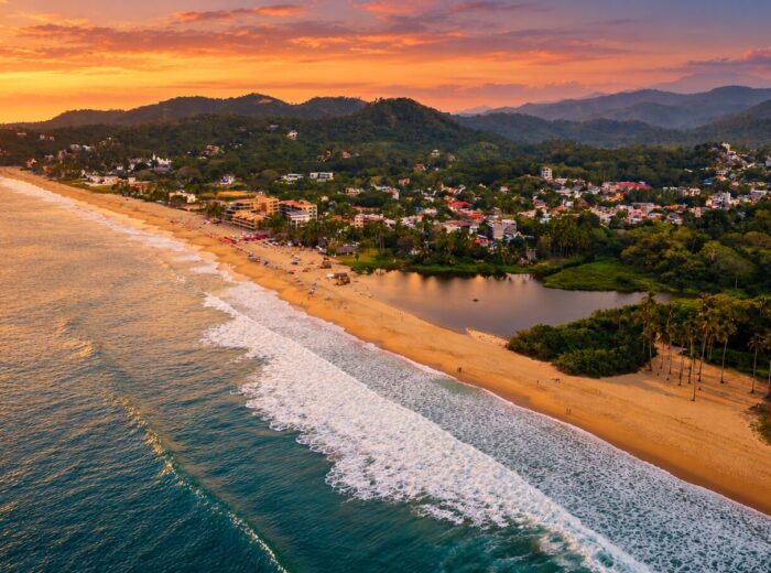
The most visited region and the easiest to reach: it starts 10 minutes from Puerto Vallarta airport and follows Federal Highway 200 north. The full guide is in Riviera Nayarit, among the best destinations to visit.
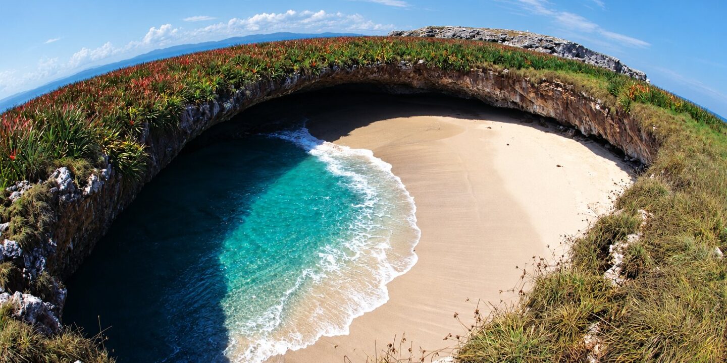
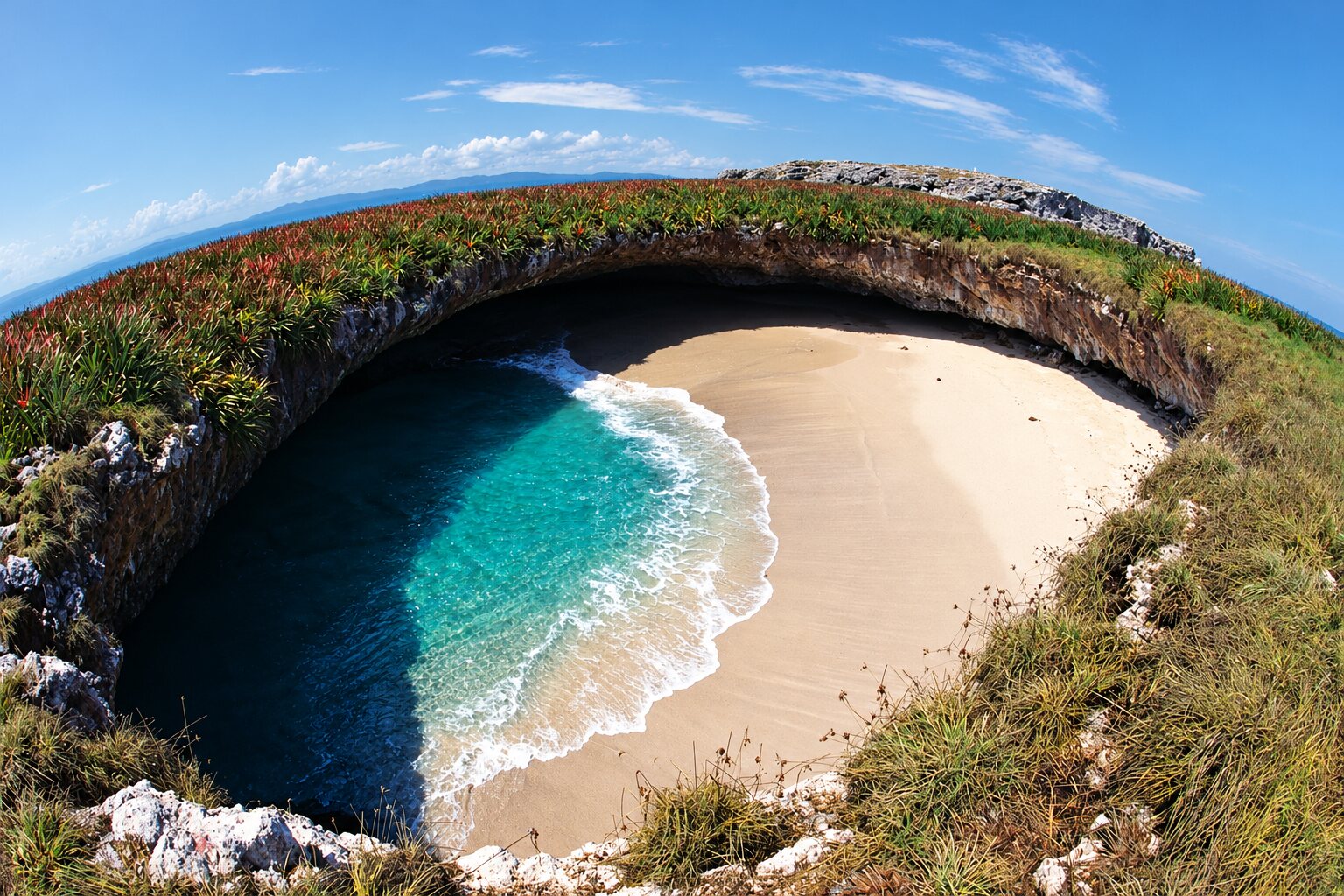
- Islas Marietas. A national park about 8 km off Punta de Mita, home of the famous Playa del Amor (Hidden Beach) inside a crater you reach by swimming through a tunnel. Access is capped daily by CONANP, Mexico’s protected-areas agency; shared tours from Punta de Mita cost approx. $1,200–1,900 MXN (65–100 USD) in 2026.
- Sayulita. A surfing Pueblo Mágico with the friendliest learner wave on the coast. A 1.5–2 hour lesson with board runs about $1,000–1,600 MXN (57–90 USD).
- San Pancho. Ten minutes from Sayulita and far calmer: a wide beach, big sunsets and an artsy vibe. The surf is strong, so swim with care.
- Punta de Mita. Beginner surf and snorkeling at El Anclote, long rides at La Lancha and short boat trips to the Marietas.
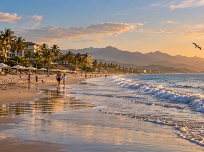
- Bucerías and La Cruz de Huanacaxtle. A long family beach, a seafront promenade, La Cruz’s Sunday market (November to April) and humpback whales from December to March.
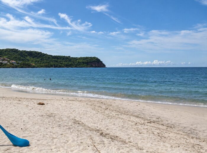
- Rincón de Guayabitos. The calmest bay on the coast, ideal with small children, with boats to Isla del Coral for snorkeling.
Compare every beach in the best beaches in Nayarit.
Tepic and surroundings: city, volcanoes and a crater lake
The capital, at about 900 m (2,950 ft), is the cheapest and most central base in the state. See the Tepic page for hotels and transport.
- Historic center and museums. The Cathedral of the Purísima Concepción on the main square, the Regional Museum of Nayarit (run by INAH, the national archaeology institute), Casa Aguirre and the Museum of the Five Peoples, devoted to Wixárika, Cora, Tepehuan, Mexicanero and mestizo cultures. Try tostadas, gorditas and tejuino (a fermented corn drink) downtown.
- Sangangüey volcano. The 2,340 m volcano that dominates the city skyline; the guided round-trip hike takes 7–8 hours. More options in Nayarit volcanoes.
- Jumatán waterfall. The tallest in the state (about 110 m), 20 km from Tepic on the toll road to Mazatlán. You walk down roughly 650 steps; go in the dry season.
- Santa María del Oro lagoon. A flooded volcanic crater about 2.5 km across, roughly 1 hour from Tepic: kayaking, swimming and lakeside restaurants serving chicharrón de pescado (crispy fried fish).
Southern Magical Towns: volcano, archaeology and hot springs
The Tepic–Guadalajara highway corridor links four of the Magical Towns of Nayarit.
- Compostela. Founded in 1530, 40 km from Tepic: the parish church of Santiago Apóstol, an archaeology museum and leather-saddlery workshops.
- Jala. The Basilica of Our Lady of the Assumption, the Corn Fair in August (cobs over 40 cm long) and the Meseta del Cielo vineyard on the Juanacatlán plateau.
- Ceboruco volcano. Nayarit’s only active volcano (2,280 m; last eruption 1870–1875). A road climbs from Jala to the antennas and fumaroles; a high-clearance vehicle helps.
- Ixtlán del Río and Los Toriles. 83 km from Tepic: the archaeological site with its round temple dedicated to Quetzalcóatl, open 9:00 to 17:00, and pollo a la plaza (fried chicken in tomato sauce) under the arcades.
- Amatlán de Cañas. The hot-springs Magical Town, about 120 km from Tepic (2 h 15 min). Details in waterfalls and hot springs in Nayarit.
San Blas and the north coast: mangroves, birds and islands
Less than an hour from Tepic by toll road. See the San Blas page.
- San Blas. An 18th-century port with La Contaduría hill, Las Islitas and El Borrego beaches for longboard surfing, and some of the best birding on Mexico’s Pacific coast.
- La Tovara. A boat ride through mangrove channels to a freshwater spring where you can swim; approx. $150–200 MXN (9–11 USD) per person.
- El Cora waterfall and Tecuitata canyon. A swimming pool beneath a 40 m drop and the state’s most popular canyoning route (a guide is mandatory in Tecuitata). On the way, near Mecatán, you’ll see the Cebadilla volcano.
- Mexcaltitán. A round island about 400 m across in a lagoon in Santiago Ixcuintla, linked to the legend of Aztlán, the mythical Aztec homeland. Boats leave La Batanga landing (15–20 min); eat tlaxtihuil (shrimp-and-corn stew) and shrimp tamales.
- Isla Isabel. A national park about 70 km offshore with colonies of frigatebirds and blue-footed boobies. The crossing from San Blas takes 2.5–3 hours and is usually an overnight trip.
Sierra and Gran Nayar: living culture
- Jesús María and the Cora Holy Week. The seat of Del Nayar is about 4 hours from Tepic on mountain roads. Its Holy Week ceremony (the Judea), with painted men called “borrados”, is one of the most striking rituals in Mexico; always ask before taking photos.
- Ruiz and the sierra canyons. 63 km from Tepic and the gateway to the mountains: the Cañón del Diablo at the old Zopilote mine (with a guide), the San Pedro River and Cora communities such as San Pedro Ixcatán.
Northern Nayarit: archaeology, estuaries and the longest beach
- Tuxpan and Coamiles. About 80 km from Tepic. Coamiles hill holds more than 150 petroglyphs of the Aztatlán culture, visited with a local guide. Read our Tuxpan guide.
- Acaponeta. The “Athens of Nayarit”, 141 km from Tepic: poet Alí Chumacero’s house, the Church of the Assumption and the riverside promenade.
- Tecuala and El Novillero. Roughly 90 km of continuous sand and very gentle surf, seafood shacks and sunsets with nobody around.
3, 5 and 7-day itineraries
| Day | 3 days (Riviera) | 5 days (coast + Tepic) | 7 days (all of Nayarit) |
|---|---|---|---|
| 1 | Arrive at PVR, beach in Bucerías | Bucerías and La Cruz | Bucerías and La Cruz |
| 2 | Islas Marietas from Punta de Mita | Islas Marietas | Islas Marietas and Punta de Mita |
| 3 | Sayulita and San Pancho; fly home | Sayulita; night in Guayabitos | Sayulita and San Pancho |
| 4 | — | San Blas and La Tovara | Guayabitos and Chacala; night in San Blas |
| 5 | — | Downtown Tepic; fly out of TPQ | La Tovara, El Cora; night in Tepic |
| 6 | — | — | Mexcaltitán (early start) |
| 7 | — | — | Santa María del Oro or Jala and Ceboruco; fly out of TPQ or GDL |
Traveling with children? Cut the driving and add beach time; there’s a tested plan in Nayarit with kids.
What to visit in Nayarit by type of traveler
- First-timers: Marietas, Sayulita, San Blas and Tepic cover sea, mangroves and city in 5 days.
- Families: Guayabitos, Bucerías, sea-turtle releases (July to December) and Santa María del Oro lagoon.
- Adventure: canyoning in Tecuitata or the Cañón del Diablo, hiking Sangangüey or Ceboruco, surfing La Lancha.
- Culture and history: Los Toriles, Mexcaltitán, Coamiles, the Tepic museums and, at Holy Week, Jesús María.
- Tight budget: San Blas, Tepic and the southern towns have rooms from approx. $700 MXN (40 USD) a night in 2026.
Tips for your Nayarit vacation
- The best overall season is November to April: dry, calm seas and whales from December to March. From July to October it rains in the afternoons, but waterfalls are full and prices drop.
- A car makes multi-region trips easy: the Riviera has good buses, the sierra and the north do not.
- Carry cash for boats, cooperatives and small towns; many don’t take cards.
Frequently asked questions
What are the top things to do in Nayarit?
Snorkel at the Islas Marietas, learn to surf in Sayulita, cruise the La Tovara mangroves in San Blas, take a boat to Mexcaltitán, drive up the Ceboruco volcano, visit the Los Toriles archaeological site and eat pescado zarandeado (grilled butterflied fish) by the sea.
What should I visit in Nayarit on a first trip?
Combine the Riviera Nayarit (Marietas and Sayulita) with San Blas and downtown Tepic. In five days you see beach, mangroves, a Magical Town and the capital without long drives.
What are the main tourist attractions in Nayarit?
Islas Marietas, Sayulita, Punta de Mita, San Blas and La Tovara, Mexcaltitán, Santa María del Oro lagoon, Ceboruco volcano, Jala, Ixtlán del Río with Los Toriles and El Novillero beach.
What are some lesser-known beautiful places in Nayarit?
El Cora waterfall, Jumatán waterfall, Coamiles hill and its petroglyphs, Isla Isabel and the Jala plateau with its vineyard. All get few visitors.
How many days do I need in Nayarit?
Three days cover the Riviera Nayarit; five let you add San Blas and Tepic; seven also take in Mexcaltitán and the southern Magical Towns.
Should I base myself in Tepic or on the Riviera?
It depends on your plan: the Riviera is for beaches, surf and the Marietas; Tepic is cheaper and more central for San Blas, the sierra, Santa María del Oro lagoon and the southern Magical Towns.
Area map
- 1Sayulita Riviera Nayarit. Surfing Magical Town, 38 km from Puerto Vallarta airport.20.8689, -105.4407 · Open in Google Maps
- 2Tepic Cathedral Tepic and surroundings. Historic center, museums and the state's central base.21.5119, -104.8913 · Open in Google Maps
- 3Jala (Magical Town) Southern Magical Towns. Basilica, Corn Fair and access to Ceboruco volcano; 75 km from Tepic.21.1031, -104.4368 · Open in Google Maps
- 4San Blas San Blas and the north coast. Historic port, La Tovara and birding; 55 km from Tepic.21.5429, -105.2849 · Open in Google Maps
- 5Jesús María Sierra and Gran Nayar. Seat of Del Nayar, Cora Holy Week; approx. 4 h from Tepic.22.2513, -104.518 · Open in Google Maps
- 6Coamiles archaeological site The north. Over 150 Aztatlán petroglyphs, 7 km from Tuxpan; visit with a local guide.21.9213, -105.2544 · Open in Google Maps