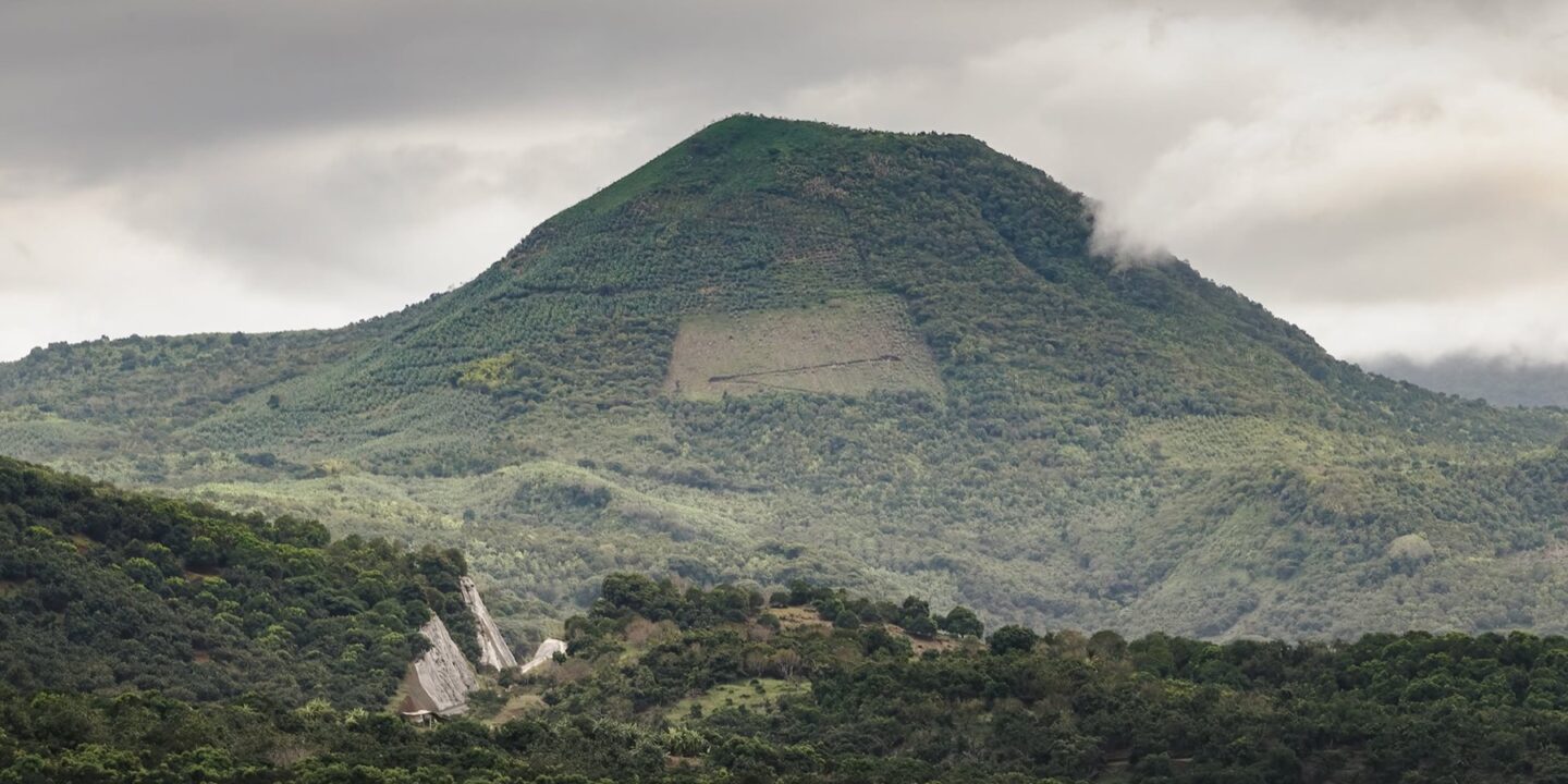
Cebadilla volcano (Cerro La Cebadilla on official maps) is a volcanic cone rising to about 860 meters above sea level in the municipality of San Blas, Nayarit, between the villages of Mecatán and Jalcocotán. It is not an active volcano and does not appear in any hazard catalog: it is a green, silent mountain, part of the sierra that steps down from Tepic to the coast, and since 2017 it has become the most photographed landmark on the Tepic–San Blas toll highway, which winds around its lower slopes.
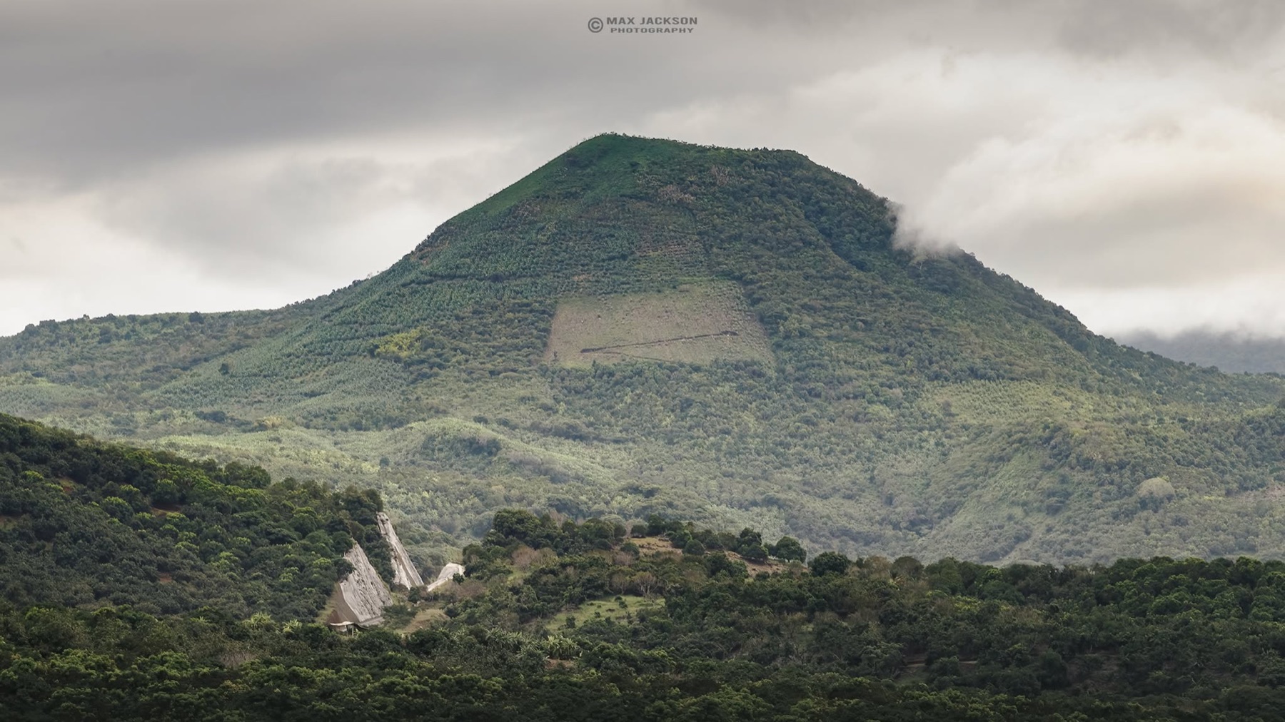
We flew a drone to the summit and, measured from the takeoff point beside the road, it read just over 500 meters of altitude: exactly the drop between the Mecatán valley (around 300 m) and the peak. From up there you see the highway threading between hills, the shade-coffee plantations of the sierra and, on clear days, the glint of the Pacific toward San Blas. Here is what it is, how to see it, how to hike it and what to combine it with on the same trip.
Where Cebadilla volcano is
The hill sits in the upland part of the municipality of San Blas, about 3 km south of Mecatán and 4 km north of Jalcocotán, two coffee-growing communities reached from the free Tepic–San Blas federal road. Its approximate coordinates are 21.5099 N, -105.1210 W (see the map at the end of this article). It belongs to the Sierra de San Juan, the western tip of the Trans-Mexican Volcanic Belt, a volcanic arc that runs from the Nayarit coast all the way to Veracruz.
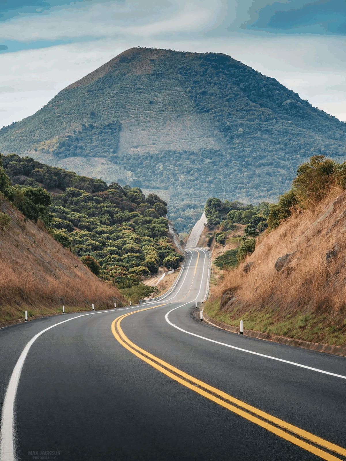
The Tepic–San Blas toll highway, 32.4 km long and opened to traffic in February 2017, crosses precisely this stretch of sierra with bridges (one at Mecatán) and a tunnel that doubles as a wildlife crossing. As you leave the mountain cuts, the Cebadilla cone appears straight ahead: that is when every passenger reaches for a phone.
Is it really a volcano?
Yes, in the geological sense: it is a volcanic edifice of the same system that shaped the Sierra de San Juan and the hills around Tepic, an arc built between 4.5 million years ago and the present. But it is not on Nayarit’s list of active volcanoes. The two giants with recent eruptive history are Ceboruco (2,280 m, last eruption 1870) and Sangangüey (2,300 m), both south and east of Tepic. Cebadilla is their little brother: far lower, cloaked in tropical forest and coffee groves, with no recorded activity.
| Volcano | Elevation | Municipality | Status |
|---|---|---|---|
| Cebadilla | approx. 860 m | San Blas | No recorded activity |
| Sangangüey | 2,300 m | Tepic | Dormant (18th century) |
| Ceboruco | 2,280 m | Jala | Active (1870) |
| Sierra de San Juan | 2,180 m | Tepic / San Blas | Dormant |
Getting there from Tepic and San Blas
The easiest way to see the volcano is to drive the Tepic–San Blas toll road: the toll is around $100 MXN (approx. 5 USD) per car in 2026 and it saves about 18 minutes over the free road. From downtown Tepic to San Blas takes 50–60 minutes on the toll road and about 1 h 30 min on the free road, which passes through Mecatán and Jalcocotán and is the way to go if you want to stop at the foot of the hill. Check how to get to Nayarit if you are coming from out of state.
| Route | Distance | Approx. time | Notes |
|---|---|---|---|
| Tepic → San Blas (toll road) | approx. 55 km | 50–60 min | Toll approx. $100 MXN; best views of the volcano |
| Tepic → San Blas (free road) | approx. 64 km | 1 h 15 – 1 h 30 | Passes Mecatán and Jalcocotán; no toll |
| Tepic → Mecatán | approx. 30 km | 40 min | Trailhead for the summit hike |
| Puerto Vallarta → Mecatán | approx. 190 km | 3 h | Via Compostela and Tepic |
By public transport, Tepic–San Blas buses on the free road stop in Mecatán and Jalcocotán; ask the driver for the “desviación a Mecatán” (Mecatán turnoff).
Hiking Cebadilla
There is no official trail or entry fee, but local hikers have logged routes starting from Mecatán and from Jalcocotán. The most complete is the Mecatán–Jalcocotán traverse over the summit: about 15 km with roughly 600 m of cumulative elevation gain, moderate difficulty, 5 to 7 hours. There is also a short, nearly flat loop of about 4.5 km along the lower slopes on coffee-farm tracks, ideal for families.
- When to hike: November to May, in the dry season, with clear skies and firm trails. In the rainy months (July–September) the hill is intensely green but clouds hide the views and mud makes the climb harder.
- Timing: start before 8:00 am; the humid heat builds from mid-morning.
- What to bring: 2 liters of water per person, insect repellent, a hat, boots with grip and a trekking pole. There is no cell signal on several stretches.
- Guide: ask in Mecatán for someone who knows the path; the coffee-farm side tracks are confusing. It is also a way to leave income in the community.
- Respect: these are private coffee plots; ask permission, do not pick fruit and carry out your trash.
Flying a drone over the volcano
Cebadilla is a perfect stage for aerial shots: an isolated cone, the ribbon of highway, the stepped sierra and the sea in the background. A few tips based on our flight:
- Take off from an open spot on the lower slopes, away from the highway, and never fly over vehicles or people.
- Budget your battery: climbing 500 m and returning uses more than usual; on our flight the ascent alone took close to half the charge.
- Wind at the top is stronger than in the valley; check the forecast and avoid the gustiest hours (after midday).
- Keep the drone in sight and follow Mexico’s unmanned-aircraft rules from the AFAC (the civil aviation agency): drones over 250 g must be registered and there are altitude and distance limits.
- The best light is the first hour of the morning, when mist lifts off the Mecatán valley, or the last hour of the afternoon with the sun dropping over the Pacific.
What else to do nearby
The volcano sits halfway between the state capital and the coast, so it pairs well with a full day in San Blas:
- El Cora waterfall: about 40 minutes away on the road to Santa Cruz de Miramar; a 40 m drop with a swimming pool. See the El Cora waterfall route and more options in waterfalls and hot springs in Nayarit.
- Sierra coffee: Mecatán and Jalcocotán live off shade-grown coffee; on the coffee route you can visit processing mills and taste local roasts.
- La Tovara: a boat ride through the San Blas mangroves, with crocodiles and birds; see the La Tovara route.
- San Blas beaches: Las Islitas, Matanchén and El Borrego to end the day with pescado zarandeado (grilled butterflied fish). See San Blas, Pacific-coast Magical Town.
- Where to stay and eat: browse San Blas hotels and restaurants in our directory.
Suggested itinerary: Tepic, Cebadilla and San Blas in one day
| Time | Activity |
|---|---|
| 7:00 | Leave Tepic on the free road toward Mecatán (40 min) |
| 8:00 | Short hike on the lower slopes or drone flight (1.5–2 h) |
| 10:30 | Coffee and breakfast in Mecatán or Jalcocotán |
| 12:00 | El Cora waterfall (swim and light lunch) |
| 15:30 | Arrive in San Blas: La Tovara or Las Islitas beach |
| 19:00 | Dinner in San Blas and return to Tepic on the toll road (50 min), or overnight in the Magical Town |
If you would rather pick your date by the weather, check the best time to visit Nayarit.
Frequently asked questions
Is Cebadilla volcano active?
No. It is a hill of volcanic origin with no recorded activity or alerts; Nayarit’s active volcanoes are Ceboruco and, to a lesser degree, Sangangüey.
How tall is Cebadilla volcano?
About 860 meters above sea level according to OpenStreetMap; the climb from Mecatán is just over 500 meters of elevation gain.
Can I hike Cebadilla without a guide?
You can, but there is no signage and the coffee-farm tracks branch constantly. We recommend going with someone from Mecatán or Jalcocotán, especially on the 15 km traverse.
Where is the best view of the volcano?
From the Tepic–San Blas toll road, on the stretch of bridges and tunnel near Mecatán, heading toward the coast. There is no formal lookout; do not stop on the shoulder.
Do I need a permit to fly a drone there?
There is no site-specific restriction, but Mexico’s AFAC rules apply: registration for drones over 250 g, line-of-sight flight and no flying over people or the highway.
Area map
- 1Cebadilla volcano summit Cerro La Cebadilla, approx. 860 m a.s.l. (OpenStreetMap). Municipality of San Blas.21.5099, -105.121 · Open in Google Maps
- 2Mecatán Coffee village north of the hill; trailhead for the summit hike.21.5365, -105.1202 · Open in Google Maps
- 3Jalcocotán Village to the south (425 m); end of the Mecatán–Jalcocotán traverse.21.4804, -105.0995 · Open in Google Maps
- 4San Blas (Magical Town) Coast, beaches and La Tovara; end of the toll road.21.5381, -105.2892 · Open in Google Maps
- 5Tepic State capital; start of the Tepic–San Blas toll road.21.5064, -104.8946 · Open in Google Maps
