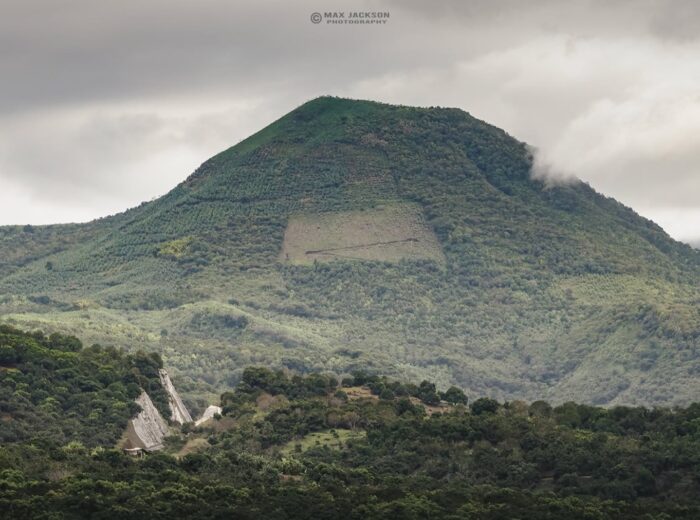
The hidden gems in Nayarit aren’t in the beach brochures: a round pyramid in Ixtlán del Río, a vineyard 1,900 meters up on volcanic soil, petroglyphs in the Compostela jungle, canyons where you jump into pools and waterfalls half an hour from Tepic, the state capital. Most are an easy day trip from Tepic and see few visitors, but many call for a local guide, the dry season or a stretch of dirt road.
We picked 13 places we can describe with verifiable facts: what they are, which municipality, how to get there, what to do, approximate cost in 2026 and whether you need a guide. They’re grouped by region, with a summary table and safety tips. If you’re looking for a name that isn’t here, check the section near the end.
Hidden gems in Nayarit: summary table
| Place | Municipality | Type | From Tepic | Difficulty |
|---|---|---|---|---|
| Los Toriles | Ixtlán del Río | Archaeological site | approx. 85 km / 1 h | Easy |
| Meseta del Cielo vineyard | Jala | High-altitude vineyard | 75 km to Jala (1 h) + mountain road | Easy |
| Jomulco waterfall | Jala | Waterfall | 82 km / 1 h 20 min | Easy |
| Real de Acuitapilco | Santa María del Oro | Waterfalls | 65 km / 1 h | Easy–moderate |
| Tepetiltic caldera | San Pedro Lagunillas | Volcano with lake | approx. 45 min | Moderate |
| Jumatán waterfall | Tepic | Waterfall | 20 km / 30 min | Moderate |
| Tecuitata canyon | San Blas | Canyoning | 44 km / 1 h 15 min | Moderate |
| Cebadilla volcano | San Blas | Volcano | 30 km / 40 min | Moderate |
| El Capomo waterfall | Compostela | Canyon and waterfall | 86 km / 1 h 45 min | Moderate |
| Altavista petroglyphs | Compostela | Rock art | approx. 80 km / 1 h 20 min | Easy |
| Isla Redonda (Marietas) | Bahía de Banderas | Island and beach | approx. 2 h 30 min + boat | Moderate (swim) |
| Coamiles hill | Tuxpan | Petroglyphs | approx. 87 km / 1 h 25 min | Moderate |
| Cañón del Diablo | Ruiz | Canyoning | 77 km / 1 h 45 min | Moderate–hard |
Southern Nayarit: archaeology, wine and volcanoes
Los Toriles, the Ixtlán del Río archaeological site
Nayarit’s most studied archaeological site lies about 3 km from downtown Ixtlán del Río on Federal Highway 15. Its highlight is the Temple of Quetzalcóatl, a circular building about 24 meters across with five staircases and a wall pierced by cross-shaped openings, a rare design in Mesoamerica. The city peaked between AD 750 and 1100. What to do: walk around some fifteen restored structures in about an hour. Hours and cost: daily 9:00 to 17:00, with the standard INAH entry fee (free on Sundays for Mexican citizens and residents). Guide: not needed.
Meseta del Cielo vineyard (Jala)
Nayarit’s first vineyard, on the Juanacatlán plateau at about 1,900 m (6,200 ft) on volcanic soil from Ceboruco. The first vines went in in 2019; Syrah and Macabeo adapted best. Getting there: the Tepic–Guadalajara highway to Jala, then the road up to the plateau via Los Aguajes; a high-clearance vehicle helps in the rainy season. What to do: a tour and tasting. Cost: depends on the tasting; by reservation only.
Jomulco waterfall (Jala)
A veil of water on the slopes of Ceboruco, 7 km from Jala. You cross a suspension bridge and walk about 2 km along the creek past tinajas (rock pools) where you can swim. Getting there: from Jala to Jomulco on a signposted rural road, with a well-kept dirt stretch. Guide: not needed. In the dry season the flow can be thin.
Real de Acuitapilco waterfalls (Santa María del Oro)
An old mining village with nine waterfalls, 20 minutes from Santa María del Oro lagoon. The closest are La Silla (the tallest) and Las Ánimas. Getting there: Highway 15 toward Guadalajara, the Santa María del Oro turnoff and a narrow rural road. Cost: approx. $100–120 MXN (6–7 USD) per person; there’s a restaurant, cabins and camping. Guide: not needed for the nearby falls.
Tepetiltic volcano caldera (San Pedro Lagunillas)
An extinct 2,020 m volcano with an elliptical caldera of 5 by 2.5 km and a lake at its northeast end. Getting there: the Guadalajara highway, San Pedro Lagunillas exit (about 45 min from Tepic), then rural roads to Tepetiltic village. What to do: hike the caldera rim in 2–3 hours. No services: bring water and food. More in Sangangüey and Ceboruco volcanoes.
Tepic and the San Blas hills: waterfalls and canyons
Jumatán waterfall (Tepic)
The tallest waterfall in the state, about 110 meters over basalt. Getting there: the Tepic–Mazatlán toll road; past the Trapichillo toll booth, look for the Jumatán sign. Access crosses a CFE hydroelectric plant, so ask permission at the gate. What to do: walk down some 650 steps to the viewpoint; the climb back is tough. Guide: no, but go with company and in the dry season.
Tecuitata canyon (San Blas)
A creek of springs, pools and stepped waterfalls with views of Matanchén Bay; it’s Nayarit’s most popular canyoning route, with jumps of 2 to 14 meters, natural slides and a rappel. Getting there: 44 km from Tepic on the road to Santa Cruz de Miramar. Cost: guided descents from approx. $1,200–1,800 MXN (65–100 USD). Guide: mandatory. See our canyoning guide to Nayarit.
Cebadilla volcano (San Blas)
An inactive cone of about 860 m beside the Tepic–San Blas toll road. Getting there: 30 km to Mecatán, a coffee village where the trail starts. What to do: hike to the summit in 2–3 hours, then finish the day in San Blas. Full guide: Cebadilla volcano.
South coast and Bahía de Banderas: jungle, rock art and islands
El Capomo waterfall (Compostela)
A jungle canyon near Las Varas, in the municipality of Compostela, with a waterfall 3.5 km up a trail (7 km round trip) from the village of El Capomo. Getting there: Federal Highway 200; from the village a dirt road leads to the trailhead and turns muddy in the rains. Guide: recommended (the trail fades in places) and mandatory for the technical descent. In winter the flow can be low.
Altavista petroglyphs (Compostela)
A rock-art site along Las Piletas creek in the hills near Chacala, with dozens of boulders carved by the ancient people of the south coast. Wixárika communities still leave offerings here. What to do: a short shaded jungle trail with signs in Spanish and English explaining the carvings. Getting there: Highway 200 toward Chacala, then a dirt road. Ask about the local fee at the entrance. Guide: not needed. Don’t touch or mark the rocks.
Isla Redonda (Islas Marietas, Bahía de Banderas)
The island in the national park that holds Playa del Amor (Hidden Beach), a crater open to the sky that you enter by swimming 30–40 meters through a tunnel. Getting there: a permitted tour from Punta de Mita (15–25 min by boat). Cost: approx. $1,200–1,900 MXN (65–100 USD) plus the CONANP wristband ($100–180 MXN). Guide: mandatory; the beach opens Wednesday to Sunday with a daily cap.
Northern Nayarit: petroglyphs and mountain canyons
Coamiles hill (Tuxpan)
Seven kilometers from Tuxpan, this hill was a ceremonial center of the Aztatlán culture (AD 850–1350) and holds more than 150 petroglyphs. There’s no ticket office or museum. Getting there: Highway 15D or free Highway 15 to Tuxpan, then the road to Coamiles. What to do: a 2–3 hour walk with a guide from the community. Go early, with water and repellent.
Cañón del Diablo (Ruiz)
At the old Zopilote mine: gorges about 800 meters deep, crystal-clear pools and a 70 m waterfall. Getting there: from Ruiz take the road to Zacatecas past El Venado; at the Tenamache creek bridge a 4 km track branches off. Cost: guided canyoning approx. $1,500–3,000 MXN (85–170 USD) with gear. Guide: mandatory.
Other names you may be searching for
Tondoroque is a town in Bahía de Banderas that keeps the name of a pre-Hispanic chiefdom; Rincón de Calimayo belongs to Santa María del Oro and Borbollón to Compostela. For Charco Azul, Las Goteras, Cañón Azul and Langarica we couldn’t find verifiable access and safety information, so we’d rather not recommend them yet. If you go, ask at the town hall and hire a local guide.
Respect and safety tips
- From July to October, never enter a canyon if it rained in the mountains: flash floods arrive in minutes.
- Pay ejido (communal land) and cooperative fees, eat in the village and pack out your trash.
- At archaeological and rock-art sites, don’t climb structures or touch the carvings.
- Use biodegradable sunscreen in pools and at the Marietas; don’t take rocks, shells or coral.
- Share your route, carry cash and don’t rely on your phone: there’s no signal in the mountains.
More ideas in waterfalls and hot springs in Nayarit and ecotourism in Nayarit.
Frequently asked questions
What are the best hidden gems in Nayarit?
Los Toriles in Ixtlán del Río, the Meseta del Cielo vineyard in Jala, Jumatán waterfall, Tecuitata canyon, El Capomo waterfall, the Altavista petroglyphs, the Tepetiltic caldera and Coamiles hill.
Where is Los Toriles in Nayarit?
About 3 km from downtown Ixtlán del Río on Federal Highway 15, an hour from Tepic. It’s open 9:00 to 17:00.
How do I get to El Capomo, Nayarit?
Take Federal Highway 200 to near Las Varas (Compostela), about 86 km from Tepic. A 3.5 km trail runs from the village to the waterfall; going with a guide is wise.
Can you visit the Meseta del Cielo vineyard?
Yes, by reservation. It sits on the Juanacatlán plateau above Jala at about 1,900 m.
What is Isla Redonda in Nayarit?
One of the two main Marietas islands, home of Playa del Amor. You can only visit on an authorized tour from the Bahía de Banderas coast.
Do I need a guide for Nayarit’s hidden places?
Yes for canyoning (Tecuitata, Cañón del Diablo), Coamiles and the Marietas. Los Toriles, Jomulco, Acuitapilco and Altavista can be done on your own.
Area map
- 1Los Toriles (Ixtlán archaeological site) Ixtlán del Río. Round Temple of Quetzalcóatl; 9:00–17:00.21.0385, -104.3448 · Open in Google Maps
- 2Meseta del Cielo vineyard Jala. Vineyard at about 1,900 m; tastings by reservation.21.1041, -104.3203 · Open in Google Maps
- 3Jomulco waterfall Jala. Waterfall with rock pools, 2 km walk.21.1017, -104.406 · Open in Google Maps
- 4Real de Acuitapilco Santa María del Oro. Mining village with nine waterfalls.21.3287, -104.5259 · Open in Google Maps
- 5Tepetiltic volcano San Pedro Lagunillas. 5 × 2.5 km caldera with a lake.21.2638, -104.6997 · Open in Google Maps
- 6Jumatán Tepic. Village by Jumatán waterfall (approx. 110 m).21.6432, -105.0316 · Open in Google Maps
- 7Tecuitata San Blas. Canyoning with a mandatory guide.21.4495, -105.1457 · Open in Google Maps
- 8Cebadilla volcano San Blas. 860 m cone; trail from Mecatán.21.5099, -105.121 · Open in Google Maps
- 9El Capomo Compostela. Start of the 3.5 km trail to El Capomo waterfall.21.1139, -105.1212 · Open in Google Maps
- 10Altavista petroglyphs Compostela. Rock art along Las Piletas creek.21.0893, -105.1686 · Open in Google Maps
- 11Isla Redonda (Islas Marietas) Bahía de Banderas. Hidden Beach; authorized tours only.20.7013, -105.5682 · Open in Google Maps
- 12Coamiles hill Tuxpan. Over 150 Aztatlán petroglyphs; local guide.21.9213, -105.2544 · Open in Google Maps
- 13El Zopilote (Cañón del Diablo) Ruiz. Old mining village, access to Cañón del Diablo with a guide.21.9585, -104.9342 · Open in Google Maps