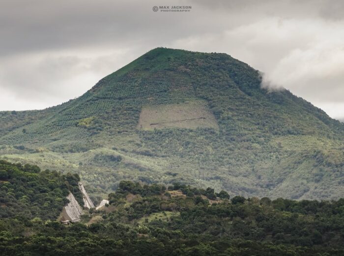
The Santa María del Oro lagoon is a lake inside a volcanic crater about 50 km (31 miles) from Tepic, a 45-minute to 1-hour drive. Expect warm fresh water, a diameter of roughly 2 km, a depth of about 65 m (213 ft) in the middle, and a shoreline lined with restaurants serving chicharrón de pescado (crispy fried fish), swimming docks, kayak rentals and campsites. It is Nayarit’s most popular freshwater escape and works as a day trip or a relaxed weekend.
This is the practical guide: how to get there from Tepic, Guadalajara and Puerto Vallarta, what to do on and off the water, what it costs in 2026, when to go and why the water changes color. If you’d rather have a weekend plan at the crater, sunsets included, jump to our 2-day itinerary. For hotels and the rest of the municipality, visit our Santa María del Oro destination page.
Santa María del Oro lagoon at a glance
- Location: Santa María del Oro municipality, central Nayarit, about 8 km from the town itself.
- Elevation: about 750 m (2,460 ft); the town sits higher, near 940 m.
- Size: about 2 km across (approx. 2.5 km along its long axis) with some 8 km of shoreline.
- Depth: close to 65 m in the center; the bottom drops off quickly from shore.
- Water: fresh, slightly alkaline, with a yearly average around 25 °C (77 °F).
- Climate: mild to warm; January is the coolest month (average around 16 °C / 61 °F) and June the warmest.
- Award: its beach held Blue Flag status for the 2025-2026 season, rare for a freshwater beach (more in the best beaches in Nayarit).
A flooded volcanic crater
The lagoon fills the floor of an extinct volcanic crater at the western end of the Trans-Mexican Volcanic Belt, the same chain that includes the Ceboruco and Sangangüey volcanoes. The walls around you are the crater rim, now covered in pine-oak forest and dry tropical forest on the sunnier slopes. Rain and runoff from those walls feed the lake, and it drains naturally at a spot locals call El Desagüe.
For scientists, the lake is an archive: its finely layered sediments hold a climate record of the last 2,600 years, including historic droughts and even ash layers from Ceboruco. For the bigger geological picture, compare this crater with six others in our guide to Nayarit volcanoes.
Where the name Santa María del Oro comes from
The “gold” (oro) in the name is no metaphor. In 1530 the place was called Santa María de Acuitapilco, after the town’s patron saint and the Acuitapilco mine at the tail end of the lagoon. In 1594 it was renamed Santa María del Oro because three fine-gold mines were worked near the village. Mining shaped the municipality’s history in colonial times and still lends its name to Real de Acuitapilco, the old mining village with the waterfalls.
Locals also like to say the lagoon “has no bottom.” Scientific soundings say otherwise: the center is about 60 to 65 meters (200–213 ft) deep, enough for the water to look almost black from a boat.
Why does the lagoon change color?
The same water can look cobalt blue in the morning, turquoise at noon and dark green on a cloudy afternoon. It isn’t a camera trick; several things work together:
- Light and sky: deep and sheltered by the crater walls, the lake mirrors the sky. High sun and clear skies bring turquoise; clouds or a low sun bring darker blues and greens.
- Carbonate crystals: in the warm, rainy months the lake precipitates aragonite, a calcium carbonate that forms ultra-fine particles. Those pale particles scatter light and push the water toward turquoise.
- Plankton: the lake is mesotrophic (moderate nutrients). At times algae and cyanobacteria tint it green and occasionally form surface scums.
- Winter mixing: most of the year the lake is layered, with warm water on top and cold water below (the boundary sits 16 to 24 m down). From late January to early March the whole column mixes, nutrients rise and the color tends to dull.
Tip: for the brightest turquoise, go between 11 a.m. and 2 p.m. on a clear day in the dry season. If you see green scum along one stretch of shore, swim somewhere else.
Things to do at the Santa María del Oro lagoon
Kayaking and paddleboarding
This is the main event. With no waves or currents, the lake is perfect even for first-timers. You can rent at the boat landing and at the docks of several hotels and restaurants. Mornings are calmest, with glassy water and little wind. A full lap of the crater is about 8 km; most people paddle for an hour or two near shore.
Swimming
Swim from the docks or from the Blue Flag beach. The water is pleasant most of the year, but it gets deep fast: wear a life vest if you’re not a strong swimmer and never swim across without a kayak or boat alongside.
Boat rides and fishing
Motorboats offer 30- to 45-minute laps of the lake. Anglers fish for bass and tilapia (mojarra) from boats or the shore; ask at the landing about permits and areas.
Hiking and viewpoints
The road down from town to the crater has several lookouts with full views of the lake, and trails follow the rim through pine and oak. Wear closed shoes and skip the hottest hours.
Adventure at Real de Acuitapilco
About 12 km (20 minutes) away, Real de Acuitapilco is an old mining village with nine waterfalls, the tallest being La Silla. An adventure park there runs ziplines, rappelling beside the falls and horseback rides. Details in waterfalls and hot springs in Nayarit.
Camping, cabins and glamping
The shore has campsites with restrooms and showers, plus cabins and small hotels with water views; browse options in the directory. If you want proper lakeside glamping in a tent, the documented option is in neighboring San Pedro Lagunillas, an hour away: glamping at the edge of the lagoon. To compare both lakes, read Nayarit’s two lagoons.
Approximate prices in 2026
| Activity | Duration | Approx. price 2026 |
|---|---|---|
| Kayak rental | 1 hour | $200–350 MXN (11–20 USD) |
| Paddleboard (rental or lesson) | 1 hour | $200–350 MXN (11–20 USD) |
| Boat ride | 30–45 min | approx. $150 MXN (8 USD) per person |
| Chicharrón de pescado or frog legs | Plate | $180–300 MXN (10–17 USD) |
| Zipline and rappel at Acuitapilco | Half day | Depends on package |
Bring cash: not every lakeside business takes cards, and cell signal inside the crater is patchy.
Where to eat: chicharrón de pescado
Santa María del Oro is the birthplace of chicharrón de pescado: chunks of fish fried until crisp, eaten with tortillas, red onion, lime and stone-ground salsa. Frog legs, breaded or in garlic sauce, are the town’s second-most-famous dish. Lakeside restaurants, several with decks over the water, also serve ceviche, aguachile, shrimp and fried tilapia. For the wider picture of the state’s food, see traditional dishes from Nayarit.
How to get to the Santa María del Oro lagoon
| From | Distance | Approx. time | Route |
|---|---|---|---|
| Tepic | 50–55 km | 45 min – 1 h | Highway 15/15D toward Guadalajara, Santa María del Oro junction, state road to the crater |
| Guadalajara | approx. 195 km | 2 h 30 min – 2 h 45 min | Toll highway 15D toward Tepic, Santa María del Oro exit |
| Puerto Vallarta airport (PVR) | approx. 200 km | 2 h 45 min – 3 h | Highway 200 to Compostela and Tepic, then highway 15 to the junction |
| Tepic airport (TPQ) | approx. 50 km | 45 min – 1 h | Tepic bypass and highway 15 to the junction |
| Real de Acuitapilco | approx. 12 km | 20 min | Narrow rural road, partly unpaved |
From Tepic: head toward Guadalajara and take the signed turnoff to Santa María del Oro; the road passes through town and then winds down to the crater rim, where the whole lake suddenly appears. From Guadalajara: no need to enter Tepic, since the Santa María del Oro exit comes before the capital. By public transport: buses run from Tepic to the town, but the lake is about 8 km farther, so you’ll need a taxi. A car makes it easy to move between the shore, the town and Acuitapilco. More routes and airports in how to get to Nayarit.
Best time to visit
| Months | Weather | How the lake looks | Best for |
|---|---|---|---|
| November – May (dry) | Sunny; cool mornings December to February | Most intense blues and turquoise (except during the January–March mixing) | Kayaking, photos, camping |
| June – October (rainy) | Warm, afternoon storms | Lush green crater; deeper water tones | Scenery and weekday deals |
| Holy Week, long weekends, December | Varies | Busy shoreline | Book hotels and tables days ahead |
On weekdays the lake is almost empty. To plan around the weather, check Nayarit weather month by month and the best time to visit Nayarit.
A weekend at the lagoon: 2-day itinerary
You can enjoy the lagoon in a day, but one night on the shore lets you see its full range of colors: cobalt blue at dawn, turquoise at midday and an orange-and-lilac mirror at sunset. Here’s a tried-and-tested two-day plan:
| When | Plan | Tip |
|---|---|---|
| Day 1, midday | Drive in from Tepic; stop at the lookouts on the road down into the crater | The whole lagoon appears on the last bend: have your camera ready |
| Day 1, afternoon | Check in at a lakeside hotel or cabin and swim from the dock | Wear a life vest if you’re not a strong swimmer: the shore drops off fast |
| Day 1, sunset | Dinner on a terrace over the water | Book a table on weekends and long weekends |
| Day 2, morning | Kayak or paddleboard on glassy water | Head out before 10 a.m., when there’s less wind |
| Day 2, midday | Fish chicharrón around El Desagüe | Bring cash |
| Day 2, afternoon | Zip lines, rappelling or a walk to La Silla waterfall in Real de Acuitapilco | Closed-toe shoes and clothes that can get wet |
If you have a third day, continue to Jala and Ceboruco or head back via Tepic; more getaway ideas in weekend routes in Nayarit.
Tips for your visit
- Use biodegradable sunscreen: this is a closed ecosystem and whatever goes in stays in.
- Arrive early for calm paddling; the wind picks up after midday.
- Don’t swim far out without support: the center is more than 60 m deep.
- Pair the lake with Tepic or with Jala and Ceboruco for a weekend.
Frequently asked questions
How far is the Santa María del Oro lagoon from Tepic?
About 50–55 km, a 45-minute to 1-hour drive via the Guadalajara highway and the Santa María del Oro junction. From Guadalajara it’s about 195 km, roughly 2 h 30 min to 2 h 45 min.
Why does the lagoon change color?
It’s a mix of light and sky reflection, carbonate particles the lake produces in the warm season, plankton and winter mixing of the water. The brightest turquoise shows up around noon on clear days.
Can you swim in the Santa María del Oro lagoon?
Yes, from the docks and the beach. The water is warm but deepens quickly, so wear a life vest if you’re not a strong swimmer and avoid patches of algae scum.
How deep is the lagoon?
Close to 65 meters in the center, and about 2 km across. It is a flooded extinct volcanic crater.
Can you camp at the lagoon?
Yes. There are campsites with restrooms and showers on the shore, plus cabins and small hotels. Book ahead for Holy Week and December.
What should I eat at Santa María del Oro?
Chicharrón de pescado, the local specialty, and frog legs, plus ceviche, aguachile and fried tilapia at the lakeside restaurants.
Area map
- 1Santa María del Oro lagoon Flooded volcanic crater: about 2 km across, approx. 65 m deep, 750 m a.s.l.21.3694, -104.5689 · Open in Google Maps
- 2Santa María del Oro (town) Municipal seat, about 8 km from the lagoon; buses from Tepic.21.3324, -104.5862 · Open in Google Maps
- 3Real de Acuitapilco Mining village with nine waterfalls, ziplines and rappelling; 20 min from the lagoon.21.3287, -104.5259 · Open in Google Maps
- 4Tepic State capital; 50–55 km and 45 min – 1 h to the lagoon.21.5064, -104.8946 · Open in Google Maps