How to Get to Nayarit: Flights, Buses and Driving
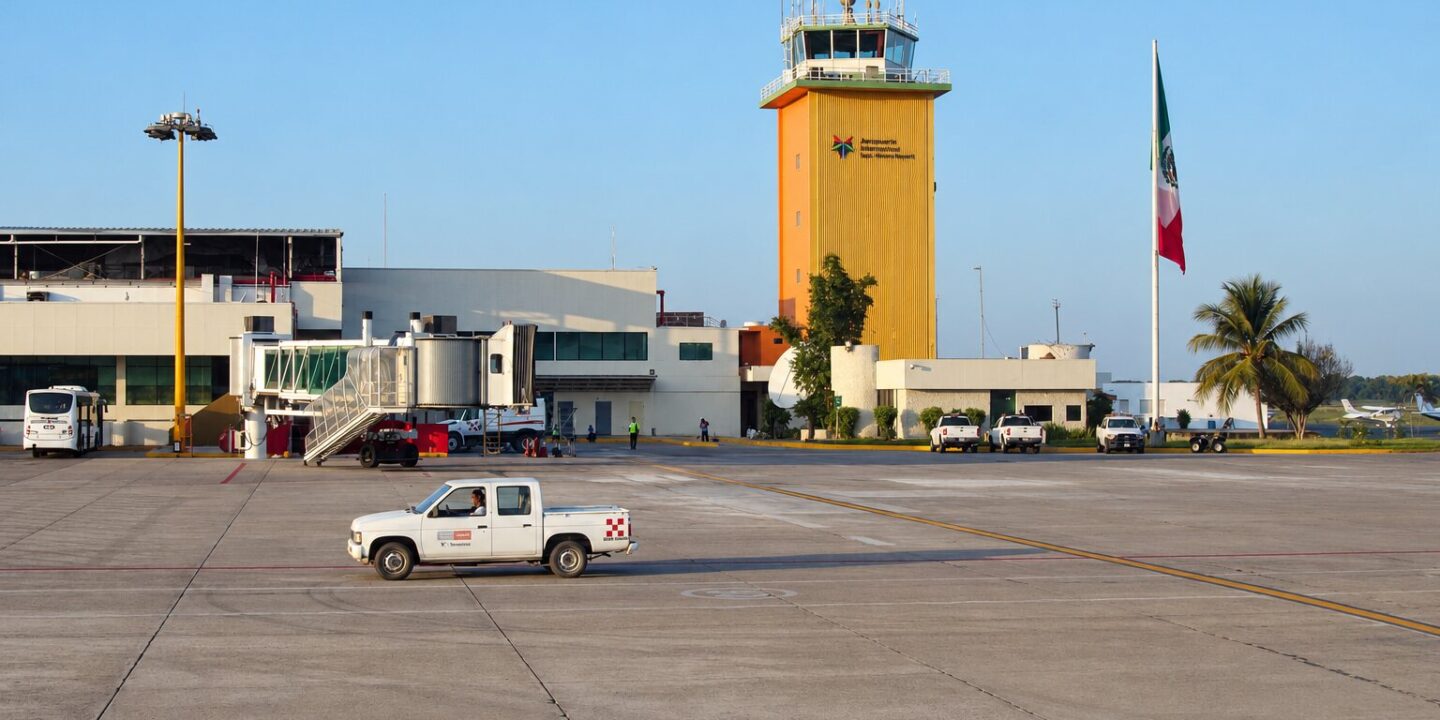
How to get to Nayarit depends on which part of the state you’re headed for. There are two gateways by air: Puerto Vallarta International Airport (PVR) in the south, the best choice for the Riviera Nayarit (Nuevo Vallarta, Sayulita, Punta de Mita, San Pancho), and Tepic’s Amado Nervo airport (TPQ) in the center, ideal for the capital, San Blas, Santa María del Oro and the inland Pueblos Mágicos (Mexico’s officially designated “Magical Towns”). By road, highway 15D links Guadalajara and Mazatlán with Tepic, and the Jala–Puerto Vallarta highway, finished in December 2024, connects the interior with the coast in under two hours.
Below: PVR vs. TPQ, routes from the U.S., Canada, Mexico City, Guadalajara, Monterrey and Mazatlán (distances, times and approximate 2026 prices), airport transfers to the Riviera Nayarit, Tepic and the Magical Towns, and a full distance table.
Where is Nayarit?
Nayarit is in western Mexico on the Pacific coast. It borders Sinaloa and Durango to the north, Zacatecas and Jalisco to the east, and Jalisco and the ocean to the south. It covers 27,857 km² (about 10,750 sq mi, 1.4 % of Mexico) and has 1,235,456 residents (2020 census). The quick way to place it: it starts just north of Puerto Vallarta and lies 2 h 45 min northwest of Guadalajara. The capital is Tepic; the best-known tourist area is the Riviera Nayarit, the roughly 300 km (185 miles) of coastline from Nuevo Vallarta north to Tecuala. The Islas Marías and the Islas Marietas also belong to Nayarit.
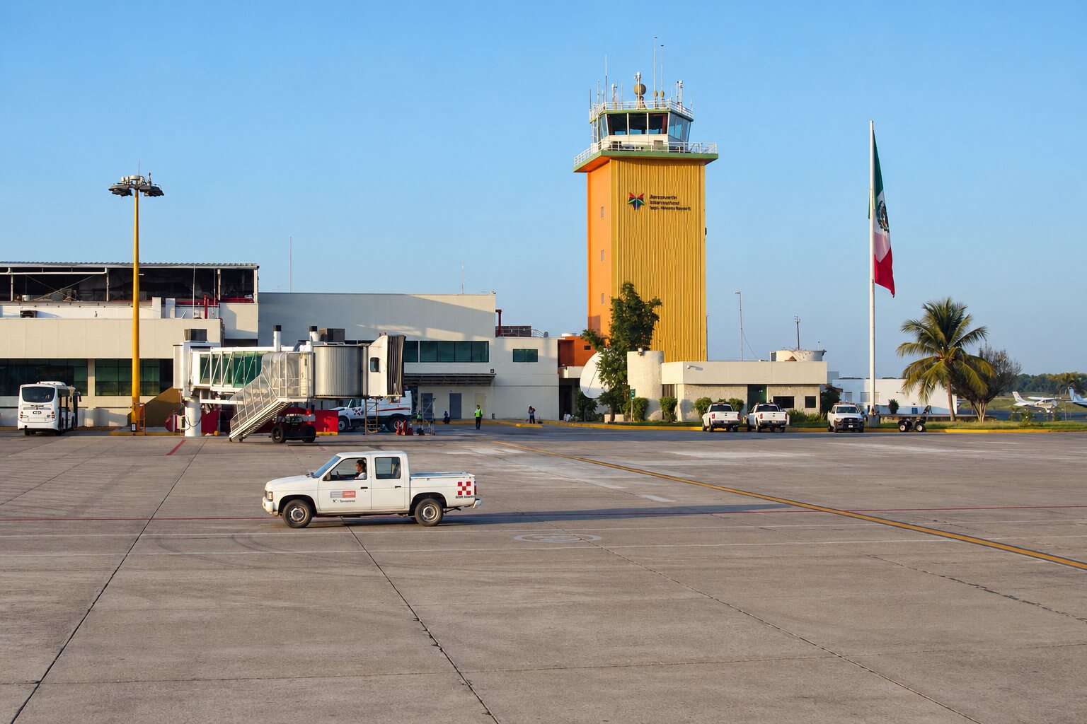
How to get to Nayarit by air: PVR vs. TPQ
| Puerto Vallarta (PVR) | Tepic Amado Nervo (TPQ) | |
|---|---|---|
| Location | Jalisco, 10 km (6 mi) from the Nayarit state line | Tepic, 15 min from downtown |
| Typical airlines (2026) | Aeroméxico, Volaris, Viva, American, United, Delta, Alaska, Southwest, Air Canada, WestJet and more than 20 in total | Volaris and Viva (domestic); seasonal U.S. routes |
| Destinations | More than 50 across Mexico, the U.S. and Canada | Mexico City (AICM and AIFA), Tijuana, Monterrey, Ciudad Juárez; seasonal Los Angeles and Houston |
| To Nuevo Vallarta / Bucerías | 20 / 30 min | 2 h 15 min |
| To Sayulita / San Pancho | 50 min / 1 h 5 min | 1 h 45 min / 2 h |
| To Punta de Mita | 55 min | 2 h 30 min |
| To Tepic | 1 h 45 min (toll highway) | 15 min |
| To San Blas | 2 h 45 min | 1 h |
| To Jala / Compostela | 1 h 30 min / 1 h 10 min | 1 h / 45 min |
Rule of thumb: if you’re staying anywhere between Nuevo Vallarta and Chacala, fly into PVR; if you’re going to Tepic, San Blas, the sierra or the north of the state, fly into TPQ or Guadalajara. A third useful option is Mazatlán (MZT), 3 h 30 min from Tepic and 2 h from Tecuala and El Novillero beach.
Flying from the U.S. and Canada
For almost every visitor from the U.S. or Canada, the answer is PVR. It has the widest choice of flights, with U.S. carriers (American, United, Delta, Alaska, Southwest) and Canadian ones (Air Canada, WestJet) plus Mexican airlines. Tepic’s seasonal routes to Los Angeles and Houston are worth checking if you’re heading inland. The airport is in Jalisco; most Riviera Nayarit resorts are 20 to 60 minutes north.
How to get to Nayarit from Mexico City
- By air: Mexico City–Puerto Vallarta takes 1 h 30 min, with more than 15 daily flights on Aeroméxico, Volaris and Viva; fares start around 900–2,500 MXN ($50–135 USD) one way. Mexico City–Tepic takes 1 h 20 min on Volaris (AICM) and Viva (AIFA), from around 1,500–2,500 MXN.
- By bus: Mexico City–Tepic is about 800 km (500 miles) and 10 to 12 hours on highway 15D via Guadalajara, for 1,000–2,500 MXN depending on the class (ETN, Primera Plus, Futura). Mexico City–Puerto Vallarta takes 12 to 13 hours. Most departures leave from Terminal Norte.
- By car: 800 km and 9 to 10 hours on highways 15D and 15 via Querétaro, Guadalajara and Tepic. Budget roughly 1,500–1,800 MXN in tolls in 2026 and consider an overnight stop in Guadalajara.
From Guadalajara
This is the most popular overland route. By car, highway 15D reaches Tepic in 2 h 45 min (220 km / 135 mi, three toll booths, about 550–650 MXN). For the Riviera Nayarit, take the Jala–Puerto Vallarta highway: Guadalajara to Bucerías in 2 h 30 min, with tolls of around 1,380 MXN in total in 2026 (El Arenal, Plan de Barrancas, Amado Nervo and Puerto Vallarta). By bus, Guadalajara–Tepic costs 350–750 MXN and takes 3 h to 3 h 45 min; Guadalajara–Puerto Vallarta, 720–900 MXN and 4 h 30 min to 5 h. By air, GDL–PVR is a 50-minute flight.
From Monterrey and Mazatlán
- Monterrey: nonstop flights go to Puerto Vallarta (1 h 50 min) and to Tepic on Volaris. Overland it’s about 1,000 km (620 mi), 12 to 14 hours by bus via Zacatecas and Guadalajara.
- Mazatlán: highway 15D runs south to Tepic in 3 h 30 min (280 km / 175 mi); by bus, 3 h 30 min to 4 h 30 min for about 650–900 MXN. If you’re headed to northern Nayarit (Tecuala, Acaponeta, El Novillero), Mazatlán is only 2 hours away.
Getting from Puerto Vallarta airport to the Riviera Nayarit
When you leave PVR, a pedestrian bridge crosses highway 200: on the airport side you’ll find the official airport taxis and pre-booked transfers; on the far side, local buses and ride-hailing apps. Approximate times and prices in 2026:
| Destination | Distance | Time | Compostela bus (green and white) | Taxi / private transfer |
|---|---|---|---|---|
| Nuevo Vallarta | 12 km (7 mi) | 20 min | 20–30 MXN | 400–600 MXN ($22–33 USD) |
| Bucerías | 18 km (11 mi) | 30 min | 25–35 MXN | 500–700 MXN |
| Punta de Mita | 45 km (28 mi) | 55 min | 40–60 MXN (change in La Cruz) | 900–1,300 MXN ($50–70 USD) |
| Sayulita | 40 km (25 mi) | 50 min; 1 h 30 min by bus | 50–60 MXN (about $3 USD) | 700–1,000 MXN ($40–55 USD); shared shuttle approx. $33 USD |
| San Pancho (San Francisco) | 48 km (30 mi) | 1 h 5 min | 55–70 MXN | 800–1,100 MXN |
| Rincón de Guayabitos | 75 km (47 mi) | 1 h 30 min | 90–120 MXN | 1,400–1,800 MXN |
The Compostela bus runs every 15–30 minutes from 6 a.m. to 10 p.m. and stops in every town along highway 200. It’s the cheapest option, but slow and tight for big suitcases. For Sayulita we have a dedicated guide: how to get to Sayulita. If you’ll be based on Banderas Bay, our Bahía de Banderas page explains each town around the bay.
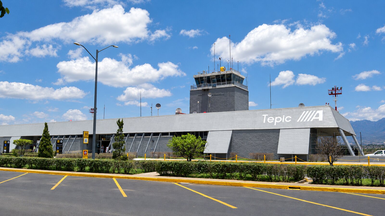
How to get to Tepic
Tepic sits where every route crosses: highway 15D (Guadalajara–Mazatlán), the toll road to San Blas and the new highway to the coast. The main bus station concentrates the first-class lines, and from Amado Nervo airport to downtown it’s 12 km, about 200–300 MXN by taxi. Everything else (what to do, weather, bus options) is on our Tepic, state capital page.
Getting to the Magical Towns: Jala, Compostela and more
- Jala (Ceboruco volcano): right off highway 15D, 80 km from Tepic (1 h) and 140 km from Guadalajara (1 h 45 min); take the Jala interchange by the Ahuacatlán toll booth, which is also where the highway to Puerto Vallarta begins. Guadalajara–Tepic buses that stop in Jala or Ixtlán del Río cost 250–450 MXN. Full guide: Jala, Magical Town.
- Compostela: 35 km from Tepic on the Tepic–Compostela highway (45 min) and 1 h 10 min from PVR via the Jala–Vallarta highway. Local buses leave Tepic’s station every 30 minutes for about 60–80 MXN.
- San Blas: 70 km from Tepic on the Tepic–San Blas toll road (1 h); buses every hour from Tepic for about 100–130 MXN.
- Sayulita and Mexcaltitán: Sayulita from PVR (see above); Mexcaltitán via Santiago Ixcuintla, 1 h 40 min from Tepic, plus a 15-minute boat ride from the La Batanga landing.
All seven Magical Towns are covered in Magical Towns of Nayarit, and the full map of municipalities is in destinations of Nayarit.
Distance and travel-time table
| Origin → destination | Km (mi) | Time | Route |
|---|---|---|---|
| Guadalajara → Tepic | 220 (135) | 2 h 45 min | Highway 15D |
| Guadalajara → Bucerías / Nuevo Vallarta | 300 (185) | 2 h 30 min – 3 h | 15D + Jala–Vallarta highway |
| Guadalajara → Sayulita | 300 (185) | 3 h | Jala–Vallarta + highway 200 |
| Mexico City → Tepic | 800 (500) | 9–10 h by car / 10–12 h by bus | 15D via Guadalajara |
| Mazatlán → Tepic | 280 (175) | 3 h 30 min | Highway 15D |
| Monterrey → Tepic | 1,000 (620) | 11–13 h by car | Zacatecas – Guadalajara – 15D |
| Puerto Vallarta (PVR) → Sayulita | 40 (25) | 50 min | Highway 200 |
| Puerto Vallarta (PVR) → Tepic | 170 (105) | 1 h 45 min | Jala–Vallarta highway + 15D |
| Tepic → San Blas | 70 (45) | 1 h | Tepic–San Blas toll road |
| Tepic → Jala | 80 (50) | 1 h | Highway 15D |
To choose your travel month, see the best time to visit Nayarit; to build a budget, how much a trip to Nayarit costs; and before you go, our tips for your first trip to Nayarit. One detail that trips people up: most of Nayarit runs on Pacific Time (UTC-7), but Bahía de Banderas, home to Nuevo Vallarta, Bucerías, Sayulita and Punta de Mita, keeps Puerto Vallarta’s clock (UTC-6), one hour ahead.
Frequently asked questions
How do I get to Nayarit?
Fly into Puerto Vallarta (PVR) for the Riviera Nayarit or Tepic (TPQ) for the capital and the interior. By bus or car, highway 15D connects Guadalajara (2 h 45 min) and Mazatlán (3 h 30 min) with Tepic.
Where is Nayarit?
In western Mexico on the Pacific coast, between Sinaloa to the north and Jalisco to the south, just north of Puerto Vallarta and northwest of Guadalajara. Its capital is Tepic.
What is the closest airport to the Riviera Nayarit?
Puerto Vallarta International Airport (PVR). It sits in Jalisco, 20 minutes from Nuevo Vallarta, 50 minutes from Sayulita and 55 minutes from Punta de Mita, with nonstop flights from many U.S. and Canadian cities.
How do I get from Puerto Vallarta airport to Sayulita?
Cross the pedestrian bridge for the Compostela bus (50–60 MXN, about 1 h 30 min) or take a taxi or private transfer for roughly 700–1,000 MXN ($40–55 USD); the drive is about 50 minutes.
How do I get to Nayarit from Mexico City?
The fastest way is to fly to Puerto Vallarta (1 h 30 min, from about 900 MXN) or Tepic (1 h 20 min). By bus it’s 10 to 12 hours to Tepic for 1,000–2,500 MXN; by car, about 800 km and 9 to 10 hours on highway 15D.
What time zone is Nayarit in?
Most of the state uses Pacific Time (UTC-7). Bahía de Banderas, which includes Nuevo Vallarta, Bucerías, Sayulita and Punta de Mita, uses Puerto Vallarta’s time (UTC-6).
Area map
- 1Puerto Vallarta International Airport (PVR) Gateway to the Riviera Nayarit: 20 min to Nuevo Vallarta, 50 min to Sayulita.20.68132, -105.24962 · Open in Google Maps
- 2Tepic International Airport (TPQ) Flights to Mexico City, Tijuana and Monterrey; 15 min to downtown Tepic.21.41733, -104.83988 · Open in Google Maps
- 3Tepic bus station First-class buses to Guadalajara, Mexico City, Mazatlán and the coast.21.49829, -104.88683 · Open in Google Maps
- 4Sayulita Pueblo Mágico 40 km (50 min) from Puerto Vallarta airport.20.86893, -105.4407 · Open in Google Maps