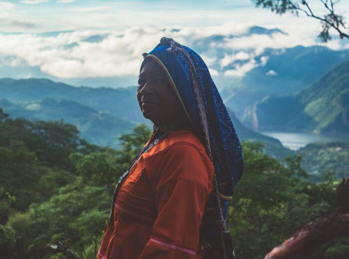
The indigenous peoples of Nayarit are four: the Cora (Náayeri), the Wixaritari (Huichol), the O’dam (Southern Tepehuán) and the Mexicaneros. Their homeland is the Gran Nayar, the stretch of the Sierra Madre Occidental where, according to tradition and colonial chronicles, a Cora ruler known as King Nayar (el Rey Nayar) united the mountain peoples in the early 16th century and held off the Spanish conquerors from the Mesa del Nayar.
His name gave the state its name, and the Cora kept venerating his memory for almost two centuries, until the Mesa del Nayar fell to Spanish troops in January 1722. This guide covers where the name Nayarit comes from, the story of King Nayar with verified dates, who the four peoples are today, Nayarit’s natural regions, the founding of Compostela and how to approach this history respectfully on your trip.
Nayarit name meaning
Nayarit comes from Náayeri, the name the Cora use for themselves, and from Nayar (or Nayarit), the ruler the Spanish encountered in the 16th century. Translations vary by source: it is often given as “son of God who is in the sky and in the sun”, while the description of the state coat of arms renders it as a Cora word linked to a “god of war”. What is certain is that the name is Cora and refers to both the people and their leader.
The territory was part of the Kingdom of Nueva Galicia, then the seventh canton of Jalisco and later the Territory of Tepic. Nayarit became a state on May 1, 1917, one of the last in Mexico to do so. More background on our About Nayarit page.
Who King Nayar was
Almost everything known about King Nayar comes from chronicles written by Spaniards (Franciscan and Jesuit missionaries) and from Cora oral tradition, so the exact dates of his life are uncertain. In its most widely accepted outline, the story goes like this:
- Early 16th century: Nayar leads a Cora domain in the sierra centered on the Mesa del Nayar, allied with Huichol and Tepehuán groups.
- 1530–1531: Nuño de Guzmán enters the region with great brutality. The mountains resist and remain outside Spanish control.
- After his death: his remains are kept in the main temple of the Mesa del Nayar and venerated as an oracle. His successors bear the title tonati, priest and ruler.
- 1716: a Spanish expedition to subdue the Mesa fails.
- Around 1720–1721: the tonati of the time negotiates with the viceroy, the Marquis of Valero, in Mexico City, but no lasting agreement is reached.
- January 1722: troops led by Juan Flores de San Pedro take the Mesa del Nayar. It is the end of Cora independence, almost two centuries after the rest of the region was conquered.
- 1722–1723: the remains attributed to Nayar are sent to Mexico City and publicly burned on the orders of the Inquisition. The tonati is taken prisoner to Guadalajara.
Jesuit missions followed the conquest (Mesa del Nayar, Jesús María, Santa Teresa) and ran until the order was expelled in 1767. Today the Mesa del Nayar and Jesús María are Cora communities with their own traditional government. Get to know the municipality in our guide to Del Nayar.
The Gran Nayar: what it is
The Gran Nayar is the historical and cultural region of the Sierra Madre Occidental shared by Nayarit, Jalisco, Durango and Zacatecas. In Nayarit it covers mainly the municipalities of Del Nayar and La Yesca, plus parts of Huajicori, Ruiz and Rosamorada. It is a land of deep canyons, high mesas and rivers such as the San Pedro Mezquital and the Santiago, where Indigenous communities keep their own forms of government, their languages and their ceremonial cycle.
The indigenous peoples of Nayarit today
Four Indigenous peoples live in Nayarit. Their languages belong to the Uto-Aztecan family, and their territories cross state lines.
| People | Language | Where they live in Nayarit | Main celebrations |
|---|---|---|---|
| Cora (Náayeri) | Cora (Náayeri) | Del Nayar (Jesús María, Mesa del Nayar, Santa Teresa), Rosamorada, Ruiz, Tepic | Cora Holy Week (la Judea) in Jesús María; farming mitote ceremonies; change of staffs in January |
| Wixaritari (Huichol) | Wixárika | Del Nayar, La Yesca (Guadalupe Ocotán), neighborhoods in Tepic and on the coast | Pilgrimage to Wirikuta; Hikuri Neixa (peyote festival); Tatei Neixa (drum festival) |
| O’dam (Southern Tepehuán) | O’dam (Southern Tepehuán) | Huajicori (San Andrés Milpillas) and the sierra bordering Durango | Mitotes (xiotalh) tied to the farming cycle; Holy Week |
| Mexicaneros | Mexicanero (a Nahuatl variety) | Small groups in the sierra bordering Durango; their core is in Mezquital, Durango | Farming mitotes and patron-saint festivals |
Náayeri: the Cora
Náayeri (plural náayerite) is the Cora people’s own name. Their religion blends pre-Hispanic tradition with Catholicism: Holy Week in Jesús María, with the “judíos” or “borrados” painted black and white, is one of the most striking ritual celebrations in the country. If you attend, follow the community authorities’ instructions and don’t photograph without permission.
Wixaritari, O’dam and Mexicaneros
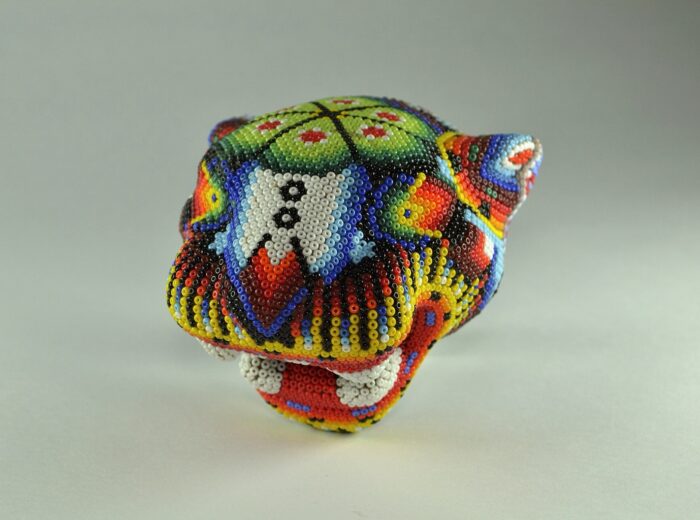
The Wixaritari are known for their beadwork, yarn art and the Ojo de Dios. The O’dam live mostly in Durango and northern Nayarit; see their region in our guide to Huajicori. The Mexicaneros are the smallest group. In Jesús María, the Indigenous radio station XEJMN, “La Voz de los Cuatro Pueblos” (The Voice of the Four Peoples), broadcasts in all four languages and in Spanish.
Natural regions of Nayarit
Nayarit covers 27,815 km² (10,739 sq mi) and is remarkably varied for its size. These are its main regions:
| Region | Sample municipalities | Features |
|---|---|---|
| Sierra (Gran Nayar) | Del Nayar, La Yesca, Huajicori | Sierra Madre Occidental, canyons, pine-oak forest; Indigenous territory |
| Northern coastal plain | Tecuala, Tuxpan, Rosamorada, Santiago Ixcuintla, San Blas | Marismas Nacionales, mangroves, estuaries, farmland |
| Center (Matatipac valley) | Tepic, Xalisco | High valley, Sangangüey and San Juan volcanoes, state capital |
| South (Volcanic Belt) | Jala, Ixtlán del Río, Ahuacatlán, Santa María del Oro | Ceboruco volcano, crater lakes, archaeological sites |
| Southern coast | Compostela, Bahía de Banderas | Riviera Nayarit, dry tropical forest, beaches |
| Islands | Islas Marías, Isla Isabel, Islas Marietas | Protected natural areas |
The founding of Compostela
Compostela was the first capital of the Kingdom of Nueva Galicia. In 1531 Nuño de Guzmán founded the Villa del Espíritu Santo on the site of present-day Tepic; a royal decree of January 25, 1531 named the territory the Kingdom of Nueva Galicia and ordered a city founded under the name Santiago de Galicia de Compostela, and the town took that name. The date usually given for the founding is July 25, 1532, the feast of Saint James, though no founding record backs it up and sources disagree. In 1540, amid conflict with local peoples, Cristóbal de Oñate moved the city to the Cactlán valley, where it stands today. It remained the capital of Nueva Galicia until 1560, when the Audiencia (royal court) and the bishopric moved to Guadalajara. Compostela is now a Pueblo Mágico (an official “Magical Town”); read our guide to Compostela.
How to approach this history respectfully today
The best gateway is Tepic. The Museo Regional de Nayarit (run by INAH, Mexico’s national institute of anthropology and history), on Avenida México downtown, displays the state’s archaeology: shaft tombs, the Aztatlán tradition and Postclassic pieces. A few blocks away there are other museums and cultural centers with art from the four peoples. More ideas in our guide to Tepic.
| From | To | Approx. distance | Approx. time | Route |
|---|---|---|---|---|
| Guadalajara | Tepic | 210 km / 130 mi | 2 h 45 min | Toll road 15D |
| Tepic | Compostela | 40 km / 25 mi | 40 min | Highway 200 |
| Tepic | Huajicori | 150 km / 93 mi | 2 h 30 min | Toll road 15D via Acaponeta |
| Tepic | Mesa del Nayar | 160 km / 99 mi | 3 h 30 min–4 h | 15D to Ruiz, then mountain road |
| Tepic | Jesús María | 180 km / 112 mi | 4–5 h | 15D to Ruiz, then mountain road |
- In the sierra, travel with a local guide or with a prior contact in the community. Communities have their own authorities, and some festivals are closed to outsiders.
- Ask before photographing people, churches or ceremonies.
- Buy crafts directly from the people who made them.
- Travel in the dry season (November–May) and fill the tank in Ruiz.
To explore every region of the state, visit destinations in Nayarit.
Frequently asked questions
Who are the indigenous peoples of Nayarit?
Four peoples: the Cora (Náayeri), the Wixaritari (Huichol), the O’dam (Southern Tepehuán) and the Mexicaneros. Most live in the sierra of Del Nayar, La Yesca and Huajicori.
Who was King Nayar?
A Cora ruler of the early 16th century who united the mountain peoples and resisted the Spanish from the Mesa del Nayar. The state of Nayarit is named after him and his people.
What does the name Nayarit mean?
It comes from Náayeri, the Cora people’s own name, and from Nayar, their ruler. Translations vary; one of the most cited is “son of God who is in the sky and in the sun”.
What is the Gran Nayar?
The Sierra Madre Occidental region shared by Nayarit, Jalisco, Durango and Zacatecas, home to the Cora, Wixaritari, O’dam and Mexicaneros. Spain did not conquer it until 1722.
When was Compostela, Nayarit founded?
Nuño de Guzmán founded the town in 1531 on the site of present-day Tepic, and it took the name Santiago de Compostela under a royal decree that year; the date usually cited is July 25, 1532. It moved in 1540 to the Cactlán valley, where it stands today.
Can you visit the Mesa del Nayar?
Yes, by a mountain road from Ruiz, about 160 km from Tepic. Go with a local guide or a community contact, in the dry season, and ask before photographing.
Area map
- 1Mesa del Nayar Former seat of the Cora domain; taken by Spanish troops in January 1722.22.2148, -104.6507 · Open in Google Maps
- 2Jesús María (Del Nayar) Seat of Del Nayar; Cora Holy Week and XEJMN radio, "The Voice of the Four Peoples".22.2513, -104.518 · Open in Google Maps
- 3Nayarit Regional Museum INAH museum in downtown Tepic: shaft tombs and the Aztatlán tradition.21.51, -104.8926 · Open in Google Maps
- 4Compostela First capital of Nueva Galicia; on its current site since 1540. Pueblo Mágico.21.2375, -104.8994 · Open in Google Maps
- 5Huajicori Municipal seat; gateway to the O'dam (Tepehuán) sierra.22.64, -105.32 · Open in Google Maps