Huajicori, Nayarit: O’dam Sierra, Candelaria and Directions
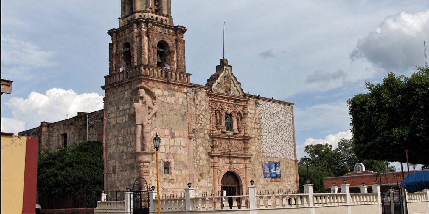
Huajicori Nayarit is the northernmost municipality in the state: a slice of the Sierra Madre Occidental that borders Durango and Sinaloa, crossed by the Acaponeta River and home for centuries to the O’dam people (Southern Tepehuán). Its municipal seat, also called Huajicori, is a quiet town at 69 m (226 ft) above sea level, just 19 km (12 mi) from Acaponeta, and it is known across the region for the feast of the Virgen de la Candelaria (Our Lady of Candlemas), which every February draws pilgrims from Nayarit, Sinaloa, Durango and Sonora.
According to Mexico’s 2020 census (INEGI), the municipality has 12,230 residents spread across 174 localities, and 3,666 of them live in the seat. This is a place for travelers interested in living Indigenous culture, rock art and mountains rather than resorts. You may also see the name spelled “Guajicori,” which reflects how it sounds; the official name is Huajicori.
Huajicori Nayarit at a glance
- Population (INEGI, 2020 census): 12,230 in the municipality; 3,666 in the seat.
- Indigenous language: 14.5% of residents aged 3 and over speak an Indigenous language, almost all of them (1,730 people) Southern Tepehuán, the O’dam language.
- Area: 2,229.55 km² (861 sq mi), 9.43% of the state.
- Elevation: from about 100 m to 2,180 m (Cerro Sapo Grande); the town sits at 69 m.
- Borders: Durango to the north and east, Sinaloa to the west (the Las Cañas River marks the line) and Acaponeta to the south.
- Name: usually interpreted as “where there is a lot of peyote,” from a Cora term for the peyote cactus.
- History: land title granted on May 22, 1714, from Nueva Vizcaya (today Durango); the Candelaria church was built in 1824, and the municipality was confirmed by Nayarit’s 1917 constitution.
Things to do in Huajicori
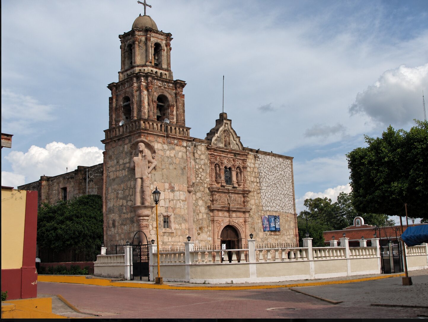
Church of the Virgen de la Candelaria
The heart of town is its church, built in 1824 and described by Mexico’s official Encyclopedia of Municipalities as one of the most interesting Baroque churches in Nayarit, with colonial-era wooden religious carvings. It houses a small image of the Virgen de la Candelaria, about 40 cm (16 in) tall. Local legend says that shortly after the town was laid out, an Indigenous washerwoman pulled a large gourd vessel out of the Acaponeta River, and the image was inside it.
La Pila de los Monos: petroglyphs by the water
Mexico’s National Institute of Anthropology and History (INAH) has recorded five rock-art sites in the municipality. The best studied is La Pila de los Monos, about 4 km (2.5 mi) northwest of town, where symbols were carved into the rock around the natural pools of the Chiote stream. Look for spirals, human figures, solar signs, lunar cycles and serpents; the later carvings show elaborately dressed figures and peyote symbols linked to Huichol (Wixárika) imagery. There is no ticket booth or signage, so ask in town for someone to guide you, and avoid the rainy season.
The Huajicori sierra and O’dam communities
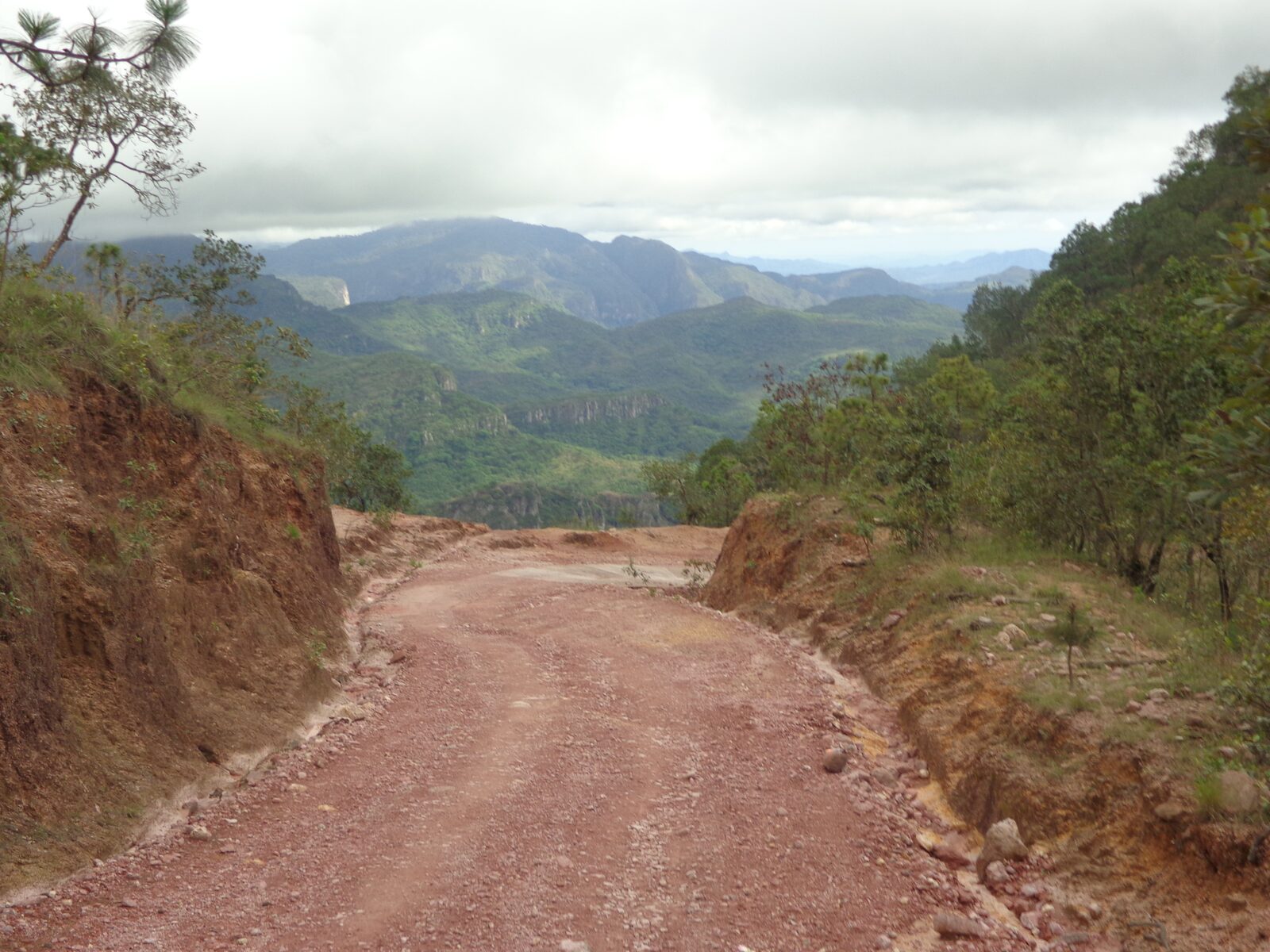
Nearly the entire municipality is mountainous (semi-flat land covers only about 5%), and more than 90% is forest and tropical woodland: pine, oak and cedar up high, deciduous forest in the canyons, with deer, peccary, puma and wild turkey. This is where the Tepehuán communities live, including San Andrés Milpillas (about 50 km / 31 mi from the seat on mountain roads), Quiviquinta (about 15 km / 9 mi north), La Murallita and Cucharas. Near San Andrés Milpillas is Mesa de los Ricos, recorded as a ceremonial center. These communities keep their traditional dances, violin, rattle and drum music, and Indigenous Holy Week celebrations.
They are communities with their own traditional authorities, not tourist attractions. If you go up, do it in the dry season in a high-clearance vehicle, check in first at the town hall in Huajicori, and never photograph ceremonies without permission. To learn more about the culture of Nayarit’s sierra, read our guide to Del Nayar, Wixárika and Cora land and the story of the ojo de dios (God’s eye weaving), one of the crafts made in Huajicori along with shoulder bags, beadwork and embroidered cloth.
The Acaponeta River and hot springs
The Acaponeta River rises in Durango and runs about 233 km (145 mi) to the Teacapán estuary, passing right by the town; in the dry season its sandy banks are where local families go to swim and picnic. The municipality also has springs: the Encyclopedia of Municipalities mentions the Caramota hot spring, about 7 km (4 mi) from the seat, whose waters are believed locally to have healing properties.
How to get to Huajicori, Nayarit
You always reach Huajicori through Acaponeta. From the Acaponeta junction on Federal Highway 15, take the Acaponeta–Huajicori road north along the river valley. Approximate driving distances and times in 2026:
| From | Distance | Time | Route |
|---|---|---|---|
| Acaponeta | 19 km / 12 mi | 25–30 min | Acaponeta–Huajicori road |
| Tepic | approx. 150 km / 93 mi | 2 h 15 min – 2 h 30 min | 15D toll road or free Highway 15 to Acaponeta, then north |
| Mazatlán, Sinaloa | approx. 175 km / 109 mi | 2 h 30 min – 2 h 45 min | Highway 15 / 15D via Escuinapa to Acaponeta |
| Guadalajara | approx. 360 km / 224 mi | 4 h 45 min – 5 h | 15D toll road via Tepic |
| San Andrés Milpillas | approx. 50 km / 31 mi | 2 h or more | Mountain roads, largely unpaved |
By public transport, travel first to Acaponeta (buses run from Tepic, Mazatlán and Guadalajara) and take local transport from there. The nearest airports are Mazatlán (MZT) and Tepic (TPQ). See all your options in how to get to Nayarit.
Huajicori weather
Huajicori has two climates: hot in the Acaponeta River valley, where the town is, and warm to temperate in the sierra. The municipality’s mean annual temperature is 23.1 °C (74 °F), and it gets around 1,478 mm (58 in) of rain a year, 92% of it between July and September. Approximate values (2005–2024 averages):
| Season | Town (69 m) | Sierra (San Andrés Milpillas) | What to expect |
|---|---|---|---|
| December – February | High 29–30 °C (84–86 °F) / low 15 °C (59 °F) | High 22–23 °C (72–73 °F) / low 8–9 °C (46–48 °F) | Best time to go; cold nights in the mountains and the Candelaria feast |
| March – May | High 32–35 °C (90–95 °F) / low 15–19 °C | High 25–29 °C / low 10–14 °C | Dry, very hot by May; Holy Week in the communities |
| June – September | High 31–34 °C / low 23–24 °C (73–75 °F) | High 25–27 °C / low 17 °C | Heavy rain; dirt roads get difficult and rivers rise |
| October – November | High 31 °C (88 °F) / low 18–22 °C | High 24–25 °C / low 12–15 °C | End of the rains, green landscapes |
Compare with the rest of the state in our guide to the best time to visit Nayarit.
The Virgen de la Candelaria feast and other traditions
| Date | Celebration | What happens |
|---|---|---|
| January 24 – February 3 (main day: February 2) | Virgen de la Candelaria (Virgen de Huajicori) | A novena (nine days of prayer) hosted by each neighborhood from January 24, the eve on February 1, Mass and the main procession with the image on February 2, and on February 3 the “fiesta del pueblo,” the locals’ own day. Pilgrimages, traditional dances, fireworks and live music; one of the oldest and best-attended religious festivals in Nayarit |
| March – April | Holy Week | Indigenous celebrations in the mountain communities |
| November 1–2 | Día de Muertos (Day of the Dead) | Altars and cemetery visits, as across Nayarit |
The town fills up during the Candelaria feast, so book a room in Acaponeta well ahead.
Food
Huajicori’s cooking is ranch and mountain food: beef and pork, venison stews in the communities, and corn and beans as the base of every meal. For the rest of the state’s cooking, from pescado zarandeado (grilled butterflied fish) to tejuino, see our guide to traditional dishes from Nayarit.
Where to stay and a northern Nayarit route
The town has basic services; most visitors stay in Acaponeta, which has hotels, banks and bus terminals, and visit Huajicori as a day trip. From there you can plan a two- or three-day loop through the north with Tecuala and El Novillero, Mexico’s longest beach. Check our hotel and restaurant directory and the rest of the destinations of Nayarit.
Huajicori Nayarit map
The map below shows the town, the Acaponeta River, Quiviquinta, San Andrés Milpillas and Mesa de los Ricos.
Frequently asked questions
Where is Huajicori, Nayarit?
At the northern tip of Nayarit, in the Sierra Madre Occidental. It borders Durango to the north and east, Sinaloa to the west and Acaponeta to the south; the town is 19 km (12 mi) from Acaponeta and about 150 km (93 mi) from Tepic.
What is the population of Huajicori?
According to INEGI’s 2020 census, the municipality has 12,230 residents, 3,666 of them in the municipal seat. About 14.5% speak an Indigenous language, almost always Southern Tepehuán (O’dam).
What is the weather like in Huajicori?
Hot in town, with highs of 29–35 °C (84–95 °F) depending on the season, and cooler in the sierra, where winter lows drop to about 8 °C (46 °F). Most rain falls from July to September; December to April is dry.
When is the Virgen de la Candelaria feast in Huajicori?
The main day is February 2 (Candlemas). A novena starts on January 24, the eve is February 1, and February 3 is the town’s own “fiesta del pueblo.” Expect pilgrimages, traditional dances, fireworks and live music, with visitors from Sinaloa, Durango and Sonora.
Can I visit San Andrés Milpillas?
It is one of the main O’dam (Tepehuán) communities in the Huajicori sierra, about 50 km from town on mountain roads. It is governed by traditional authorities, so ask for guidance at the Huajicori town hall before going.
Is Guajicori the same as Huajicori?
Yes. “Guajicori” is a phonetic spelling; the official name of the municipality and its seat is Huajicori.
Area map
- 1Huajicori (municipal seat) Municipal seat, 3,666 residents (INEGI 2020), 69 m. Church of the Virgen de la Candelaria (1824).22.64, -105.32 · Open in Google Maps
- 2Acaponeta River The river runs beside the town; sandy banks for picnics in the dry season.22.6536, -105.3203 · Open in Google Maps
- 3Quiviquinta Indigenous mountain community about 15 km north of the seat.22.7299, -105.3343 · Open in Google Maps
- 4San Andrés Milpillas O'dam (Tepehuán) mountain community, about 50 km on largely unpaved roads.22.8622, -105.119 · Open in Google Maps
- 5Mesa de los Ricos Mountain locality recorded as a ceremonial center.22.8349, -105.0806 · Open in Google Maps