Nayarit’s Pueblos Mágicos (“Magical Towns”, a designation from Mexico’s federal tourism ministry) number nine: Jala, Sayulita, Compostela, Mexcaltitán, Ahuacatlán, Amatlán de Cañas, Ixtlán del Río, San Blas and Puerto Balleto, on the Islas Marías. Nayarit is one of the states with the highest concentration of Pueblos Mágicos in Mexico, and in 2023 it received more designations than any other state: five at once. Each has its own personality, from colonial towns ringed by mountains to fishing ports that have become icons of world surfing.
In this guide you’ll find all nine in one table, with the year of designation and the distance from Tepic; what to see and eat in each; three routes to tour them; and practical tips. For the official list and an overview, see also our Magical Towns page.
What is a Pueblo Mágico?
The Pueblo Mágico designation is granted by Mexico’s federal Ministry of Tourism to towns that preserve a unique historical, cultural or natural heritage and offer visitors distinctive experiences. The program began in 2001, and the title isn’t permanent: towns must meet guidelines and can lose it, as Mexcaltitán did in 2009. In Nayarit, nine towns share the distinction today.
Nayarit’s 9 Pueblos Mágicos in one table
| Pueblo Mágico | Municipality | Designated | From Tepic (approx.) | Don’t miss |
|---|---|---|---|---|
| Jala | Jala | 2012 | 72–80 km (45–50 mi), 1 h | Basilica and Ceboruco volcano |
| Sayulita | Bahía de Banderas | 2015 | 130 km (81 mi), 1 h 45 min | Beginner surf |
| Compostela | Compostela | 2018 | 39 km (24 mi), 35–40 min | Santiago Apóstol parish and leatherwork |
| Mexcaltitán | Santiago Ixcuintla | 2001; regained 2020 | 95 km (59 mi), 1 h 40 min + boat | Museo del Origen |
| Ahuacatlán | Ahuacatlán | 2023 | 78 km (48 mi), 1 h | October 4 bullfight |
| Amatlán de Cañas | Amatlán de Cañas | 2023 | 120 km (75 mi), 1 h 50 min | Hot springs and El Manto |
| Ixtlán del Río | Ixtlán del Río | 2023 | 82 km (51 mi), 1 h 05 min | Los Toriles archaeological site |
| San Blas | San Blas | 2023 | 55–70 km (34–43 mi), 50 min – 1 h | La Tovara mangroves |
| Puerto Balleto | San Blas (Islas Marías) | 2023 | Ferry from San Blas, Mazatlán or Puerto Vallarta | Former penal colony |
Road distances calculated in 2026 from downtown Tepic.
1. Jala — the oldest current designation
Recognized in 2012, it holds the state’s oldest unbroken designation: Mexcaltitán received it earlier, in 2001, but lost it in 2009 and regained it in 2020. Surrounded by the active volcano El Ceboruco and famous for its August Corn Fair (Feria del Elote), where growers compete for the largest ear of corn in the world, a local variety raised in this volcanic soil. Its stone Lateran Basilica of Our Lady of the Assumption is one of a kind in Mexico.
From Jala a road climbs toward Ceboruco, across hardened lava and fumaroles, and 7 km (4 mi) away is the Jomulco waterfall, with swimming holes. The municipality’s highlands are also home to the state’s first vineyard, Meseta del Cielo. More on our Jala page.
2. Ahuacatlán — history and bullfighting
A town on the southern corridor, a key stop along the Camino Real between San Blas and Guadalajara. Every October 4, during the feast of St. Francis of Assisi, it holds its bullfight at the El Recuerdo bullring (1958), considered Nayarit’s only traditional bullfighting festival. Don’t miss: its mango sweets and the El Ceboruco volcano. See Ahuacatlán.
3. Amatlán de Cañas — waterfalls and chocolate
One of the most recent designations (2023), at the state’s southern tip. Its natural swimming spot El Manto, its hot springs and its artisanal chocolate workshops make it a paradise for travelers seeking nature and food. It’s the farthest of the southern towns from Tepic, so plan to sleep there or in Ixtlán del Río.
4. Compostela — almost 500 years of history
The city of Santiago de Compostela was founded in 1532 on the site of today’s Tepic and moved to its current location in 1540. It was capital of the kingdom of New Galicia and seat of its royal court (Audiencia) and first bishopric until 1560, when both moved to Guadalajara. Today it combines a colonial plaza with the Santiago Apóstol parish church, traditional leather workshops (talabarterías) making saddles and belts, and a coastline with beaches such as Chacala, La Peñita and Rincón de Guayabitos. See Compostela.
5. Ixtlán del Río — the archaeological gateway
Here you’ll find the Los Toriles archaeological site, the most important in the state, with a circular temple that, according to INAH, was dedicated to Ehécatl-Quetzalcóatl, god of the wind. The pollo a la plaza (plaza-style roast chicken) is another reason to stop. See Ixtlán del Río.
6. Sayulita — surf and bohemia
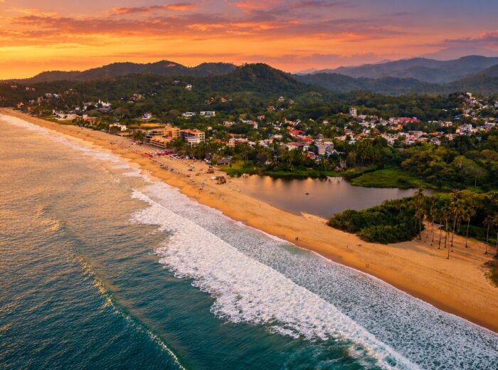
A fishing town turned into one of the most popular surf destinations in Latin America. Gentle waves, galleries, Wixárika (Huichol) art workshops, international restaurants and a lively artistic community year-round. It’s about 40 km (25 mi) from Puerto Vallarta airport. Full guide: Sayulita travel guide.
7. San Blas — the historic port
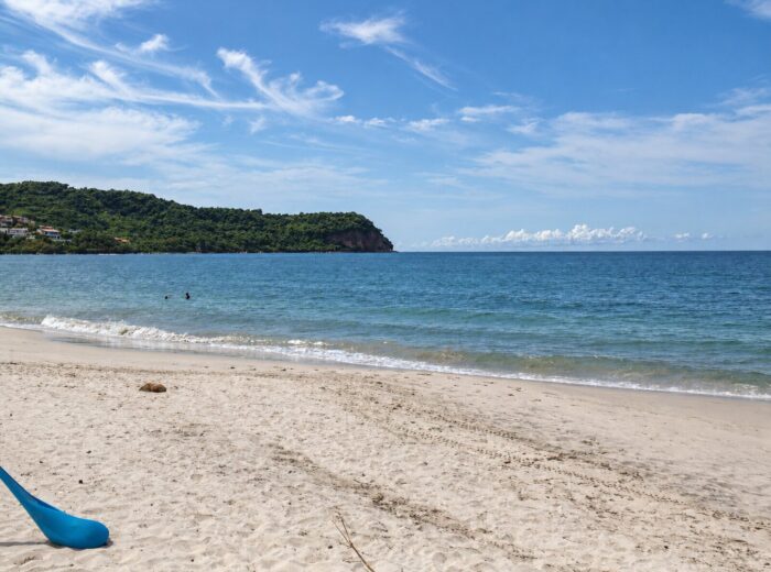
A colonial port founded in 1768 to supply the expeditions to the Californias, with the mangroves of La Tovara (a Ramsar wetland), the Contaduría Fort and more than 300 bird species, resident and migratory (the 2019 Christmas Bird Count logged 310 in one week). A paradise for birders, surfers and history lovers; beaches such as El Borrego and Las Islitas are minutes from town. See San Blas.
8. Mexcaltitán — the island in the lagoon
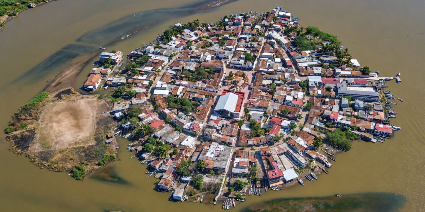
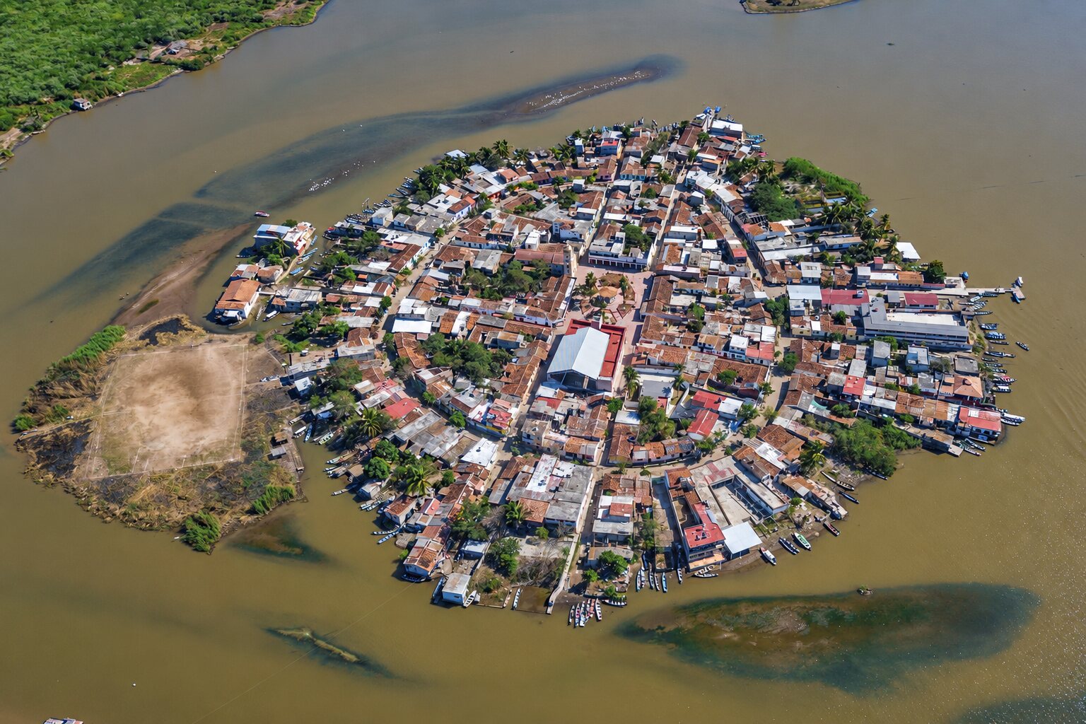
A small island about 400 m (1,300 ft) across in a lagoon in the municipality of Santiago Ixcuintla, linked by tradition to the mythical Aztlán. It was Nayarit’s first Pueblo Mágico (2001); it lost the designation in 2009 and regained it in December 2020. You reach it by boat from the La Batanga landing. The Museo del Origen, in an 1815 building by the plaza, explains the history and the legend; in the rainy season some streets flood, earning it the nickname “Mexican Venice”, and every June 29 it celebrates Saints Peter and Paul, patrons of fishermen. Full guide: Mexcaltitán.
9. Puerto Balleto — the Islas Marías
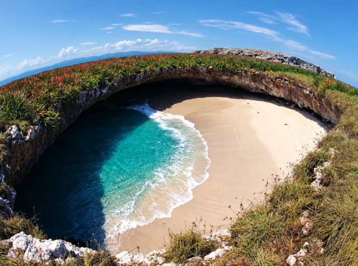
The settlement on María Madre island, a former federal penal colony (1905–2019) inside the Islas Marías Biosphere Reserve, was designated in 2023. It can only be visited on packages that include the ferry; in 2026 sailings leave from San Blas, Mazatlán and, since January, Puerto Vallarta, priced at about $6,400 to $9,500 MXN (roughly 350–530 USD) per person depending on the port, seat and services. The tour includes the site museum, the former prison and the Muros de Agua José Revueltas environmental and cultural center.
How to tour Nayarit’s Pueblos Mágicos
The southern towns (Jala, Ahuacatlán, Ixtlán del Río and Amatlán de Cañas) can be visited on a 2- or 3-day route from Tepic. Compostela and San Blas are easy to reach from the Riviera Nayarit. Sayulita is usually a destination in itself thanks to its range of hotels. Mexcaltitán lies to the north, near Santiago Ixcuintla, and Puerto Balleto requires a ferry trip.
Southern route: 2 days
- Day 1: Tepic → Jala (basilica and, in the dry season, the climb up Ceboruco) → lunch in Ahuacatlán → overnight in Jala or Ixtlán.
- Day 2: Los Toriles in Ixtlán del Río in the morning → Amatlán de Cañas for the hot springs → back to Tepic or on to Guadalajara.
The guided version, with a map, is our Magical Town route.
Coastal route: 2 or 3 days
- Sayulita as a base for surf and beach, with a side trip to Punta de Mita.
- Compostela on the way to Tepic: plaza, parish church and leather shops, with a stop at Rincón de Guayabitos.
- San Blas for the La Tovara mangroves and sunset from Contaduría hill.
Northern route: 1 day
From Tepic to Santiago Ixcuintla and La Batanga, boat to Mexcaltitán, the Museo del Origen and a shrimp lunch on the island. It pairs well with San Blas over a weekend.
Tips for visiting Nayarit’s Pueblos Mágicos
- Pick your season: the dry months, November to May, are best for the coast and Ceboruco. Jala fills up for the Corn Fair in August, and Mexcaltitán shows its “Venice” side in the rains (August and September). Compare months in the best time to visit Nayarit.
- Drive: the southern towns sit on the Tepic–Guadalajara toll road; there are buses from Tepic to San Blas, but to combine several towns a car is the most practical.
- Carry cash: markets, food stalls, boats and artisan workshops often have no card terminal.
- Respect traditions: dress respectfully in churches and ask before photographing people or a ceremony.
- Shoes and repellent: cobblestone streets in the south, mosquitoes and no-see-ums in the San Blas and Mexcaltitán mangroves.
- Book what has limited space: Puerto Balleto packages and lodging on long weekends and Holy Week; browse options in our directory.
Frequently asked questions
How many Pueblos Mágicos does Nayarit have?
Nine: Jala, Sayulita, Compostela, Mexcaltitán, Ahuacatlán, Amatlán de Cañas, Ixtlán del Río, San Blas and Puerto Balleto. The last five were designated in 2023.
What was Nayarit’s first Pueblo Mágico?
Mexcaltitán, in 2001, but it lost the title in 2009 and regained it in 2020. Jala, designated in 2012, has held it without interruption the longest.
Which Pueblos Mágicos are close to Tepic?
Compostela, about 40 minutes away; San Blas, one hour; and Jala, Ahuacatlán and Ixtlán del Río, one hour along the toll road to Guadalajara.
Which of Nayarit’s Pueblos Mágicos have beaches?
Sayulita and San Blas are on the ocean, and the municipality of Compostela includes beaches such as Chacala and Rincón de Guayabitos. Puerto Balleto is on an island.
How do you get to Puerto Balleto?
Only on a tour package with a ferry from San Blas, Mazatlán or Puerto Vallarta. Check sailing dates, inclusions and price when you book.
How many days do I need to tour Nayarit’s Pueblos Mágicos?
Two days cover the four southern towns; five or six add Compostela, San Blas, Mexcaltitán and Sayulita. Puerto Balleto needs a trip of its own.
If you have the time, no trip through Nayarit is complete without visiting at least three of its Pueblos Mágicos. To plan the rest of your trip, see the 15 must-see places in Nayarit.
Area map
- 1Jala (Magical Town) Magical Town in the southern corridor, below Ceboruco.21.1031, -104.4368 · Open in Google Maps
- 2Amatlán de Cañas Magical Town in the far south, known for hot springs and sugar mills.20.80782, -104.4046 · Open in Google Maps
- 3Compostela Magical Town; Santiago Apóstol parish and leather workshops.21.2375, -104.8994 · Open in Google Maps
- 4Ixtlán del Río Magical Town in the southern corridor.21.038, -104.3697 · Open in Google Maps
- 5Sayulita Surf Magical Town in Bahía de Banderas.20.8689, -105.4407 · Open in Google Maps
- 6San Blas Historic port and Magical Town.21.5429, -105.2849 · Open in Google Maps
- 7Ahuacatlán Magical Town at the foot of Ceboruco.21.05255, -104.48421 · Open in Google Maps
- 8Mexcaltitán Island Pueblo Mágico; island about 400 m across, reachable only by boat.21.90568, -105.47525 · Open in Google Maps