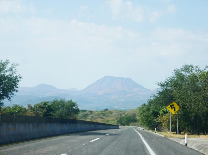
There is a Nayarit that smells not of salt and sunscreen but of café de olla, wet earth and corn fresh off the cob. It sits in the center of the state, more than 900 meters above sea level, where Tepic and its neighbor Xalisco share a valley ringed by hills and volcanoes. Most travelers pass through on their way to the coast, yet within a few kilometers this area packs museums, markets, pine forests and one of the most interesting kitchens on Mexico’s Pacific side.
This story lays out a day and a half in that highland heart: a morning in downtown Tepic among market stalls, murals and Wixárika art; an afternoon in the hills of Xalisco, where fog drifts down through the pines; and an evening devoted to chef-driven cooking that reinvents Nayarit’s seafood. You can stretch the plan with the guide to Tepic in one day or the historic Tepic route.
Morning in Tepic: market, café de olla and Indigenous art
The route starts early at Mercado Juan Escutia, the traditional market in downtown Tepic. By then the fruit aisle is in full swing: mangoes, soursops, bananas from the coast and heaps of dried chiles share space with Wixárika craft stalls, beaded necklaces and embroidered bags. The fondas inside serve café de olla, coffee simmered in a clay pot with piloncillo (raw cane sugar) and cinnamon.
A few blocks away, on Calle Hidalgo, stands the Museo de los Cinco Pueblos (formerly the Museo de los Cuatro Pueblos), housed in a 19th-century mansion. Its rooms gather folk art from the Wixárika (Huichol), Náayeri (Cora), O’dam (Tepehuan) and Mexicanero peoples, plus the mestizo population, which explains the new name. It opens Tuesday to Sunday, 10:00 to 17:00, and admission is free or a token fee.
From the museum, walk to the main square and the Cathedral of the Immaculate Conception, with its twin neo-Gothic towers, then into the downtown alleys. The Callejón de la Cultura and the nearby streets concentrate murals and painted facades that have become the most photographed corner of the city.
What to eat in downtown Tepic
Dishes worth trying before heading to Xalisco (more background in the guide to Nayarit cuisine):
- Café de olla with piloncillo and cinnamon, at the fondas inside Mercado Juan Escutia.
- Fish tacos and smoked marlin tostadas, delivered daily from the coast.
- Xalisco banana bread, the valley’s signature edible souvenir.
- Tejuino topped with lime sorbet, a fermented corn drink sold from carts around downtown.
- Elotes and esquites, especially in August, when Xalisco holds its Corn Fair.
Afternoon in Xalisco: lookouts and cloud forest
Xalisco sits right against Tepic’s southern edge; barely 8 kilometers separate one downtown from the other. It is a farming municipality known for sugarcane, corn, bananas and the August Feria del Elote (Corn Fair). The natural draw is higher up, in the hills that close off the valley, with two options depending on time and fitness:
Cerro de la Cruz
It is not in Xalisco but on the north side of the city of Tepic; still, it is the valley’s classic lookout and fits well into the afternoon. The trail, just over 3 kilometers round trip, gains about 150 meters and takes an hour. From the top you see the whole of Tepic spread out below, the outline of Sangangüey volcano to the east and, on clear days, Cerro de San Juan to the west. Go early: in the afternoon clouds tend to settle over the hills.
Parque Natural La Montaña, at La Curva
In the upper reaches of Xalisco, toward the sierra, the landscape shifts to pine and oak forest with banks of fog rising from the valley. The area known as La Curva, home to Parque Natural La Montaña, is the gateway to that forest: trails among the pines, rustic cabins and a silence broken only by the wind. The loop trails run up to 12 kilometers with nearly 400 meters of elevation gain: a half-day outing for experienced hikers. Carry water, something to eat and shoes with good grip; if you plan to go beyond the marked trails, hire a local guide.
Evening in Tepic: chef-driven cooking with a Pacific soul
The day deserves a fitting finale. Tepic has a handful of chef-driven restaurants working with produce from the Nayarit coast: shrimp from the San Blas marshes, oysters from Boca de Camichín, fish from Bahía de Banderas. These dishes sum up that kitchen:
| Dish | What it is | Why order it |
|---|---|---|
| Totoaba | A fish with a soft, delicate texture, sustainably farmed, cooked with technique that respects its flavor | A rarity few menus offer; pairs well with light citrus sauces |
| Soft-shell crab sope | A whole fried crab on a thick corn-masa base | Brings market street food and the sea together: crunchy, salty, addictive |
| Dried shrimp and coconut ceviche | Dried marsh shrimp, fresh coconut and citrus | The single bite that best describes the Nayarit coast |
It is a dinner to share, as a couple or with friends, and weekend reservations are wise. On a tighter budget, check how much a trip to Nayarit costs: the same seafood cooking, fonda-style, costs a fraction.
Suggested itinerary and travel times from Tepic
| Time | Activity | Distance and time from downtown Tepic |
|---|---|---|
| 8:00 | Breakfast and café de olla at Mercado Juan Escutia | Downtown, on foot |
| 10:00 | Museo de los Cinco Pueblos and the Cathedral | Downtown, on foot |
| 11:30 | Murals of the Callejón de la Cultura and the Regional Museum | Downtown, on foot |
| 13:00 | Lunch in Xalisco: elotes, banana bread, antojitos | 8 km, 20 minutes by car |
| 15:00 | Cerro de la Cruz (lookout) | Back in Tepic: the trail starts on the north side of the city |
| Day 2 | Parque Natural La Montaña, La Curva (Xalisco) | 25 km, 45 minutes on a mountain road |
| Evening | Chef-driven dinner in Tepic | Downtown or the Ciudad del Valle district |
How to extend the route
Less than an hour from Tepic are the Santa María del Oro lagoon and the plantations of the coffee route; to the south, Ceboruco volcano and the Magical Town of Jala; toward the coast, San Blas.
Practical info
- Getting there: Tepic has an airport (Amado Nervo) with flights from Mexico City and Tijuana, and a bus terminal with frequent departures from Guadalajara (3 hours) and Puerto Vallarta (3 hours). By car from Guadalajara it is about 220 km on the 15D toll highway. Xalisco is 20 minutes from downtown Tepic by taxi or city bus.
- Best time to visit: from November to April skies are clear and the lookouts shine; from July to September the valley turns green and fog covers the hills, but it rains in the afternoons. August brings the Corn Fair. See the best time to visit Nayarit.
- Weather: temperate. Tepic sits at about 920 m and Xalisco slightly higher; winter mornings hover around 12 to 15 °C and summer afternoons reach 30 °C. In the Xalisco mountains it can drop below 10 °C at night.
- What to pack: sneakers or boots with good soles, layers (T-shirt, sweatshirt, light jacket), a rain shell in the wet season, a water bottle, snacks, sunscreen and cash for markets and street stalls.
- Where to stay and eat: browse the site’s services directory for hotels, restaurants and guides in the area.
Frequently asked questions
How many days do Tepic and Xalisco need?
One full day covers the historic center, Cerro de la Cruz and a chef-driven dinner. With two days you can add the La Curva forest in Xalisco or a side trip to the Santa María del Oro lagoon.
Can you hike Cerro de la Cruz without a guide?
Yes. The trail is marked and takes about an hour. Go early, with water and good footwear. For the longer forest trails in Xalisco it is better to go in a group or with a local guide.
What is the difference between the Museo de los Cuatro Pueblos and the Museo de los Cinco Pueblos?
They are the same venue, on Calle Hidalgo in downtown Tepic. The name changed to include the mestizo population alongside the Wixárika, Cora, Tepehuan and Mexicanero cultures.
When is the Xalisco Corn Fair?
In the first weeks of August, around the 15th, the feast of the Assumption. It runs for just over two weeks, with a parade, food fair and concerts.
Area map
- 1Juan Escutia Market Traditional market in downtown Tepic.21.51317, -104.89272 · Open in Google Maps
- 2Tepic Cathedral Cathedral of the Immaculate Conception, facing the main square.21.5119, -104.89125 · Open in Google Maps
- 3Cerro de la Cruz Lookout north of Tepic, on the way to Bellavista.21.53466, -104.88399 · Open in Google Maps
- 4Xalisco Municipal seat, just south of Tepic.21.4516, -104.8988 · Open in Google Maps
- 5La Curva (Xalisco) Upland area of Xalisco with pine and oak forest.21.35979, -104.83692 · Open in Google Maps