There is a Nayarit that never shows up in the beach brochures. It lies at the southern tip of the state, tucked between deep ravines of the Sierra Madre Occidental, where the air smells of wet earth and freshly pressed sugarcane. That corner is Amatlán de Cañas, a Pueblo Mágico since 2023 and one of the least known and most rewarding destinations in the state.
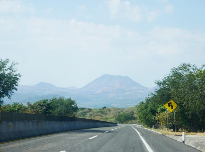
The drive is part of the experience. From the federal highway linking Tepic and Guadalajara, the road turns off near Ixtlán del Río and Ahuacatlán, climbs through tight curves with views of the Ceboruco volcano, then drops into a green valley split by a river. When the tile roofs and the bell tower appear, you know you’ve arrived somewhere nature writes the story.
This guide lays out two days in Amatlán: the first devoted to water, with waterfalls and thermal pools; the second to the town itself, its churches, its sugar mills and the taste of piloncillo. At the end you’ll find a table of the main swimming spots and a practical-info section.
Day 1: Waterfalls and Pools in the Valley
In Amatlán, life revolves around water. About ten minutes from the center is El Salto waterfall, a veil that drops more than 50 meters (165 feet) into an emerald-toned pool. The sound is a steady thunder that wipes out every other thought. Swimming beneath the fall, with its force reverberating in your chest, is the town’s welcome ritual. The site has grills and cabins, so you can turn it into a full day or an overnight camp.
The second stop is El Manto, a natural swimming hole hemmed in by stone walls where several cool, crystal-clear cascades feed a series of stepped pools. It’s the perfect place to spend the afternoon drying off on a warm rock, listening to birdsong and the river. In the nearby community of El Rosario is El Salto del Coronel, another swimming spot fed by a constant spring, with untreated water, ideal for a quiet dip.
And when your body asks for warmth, the valley delivers: thermal springs at around 37 °C (99 °F) bubble up along the river. The best known is the Agua Caliente balneario, next to the riverside malecón, with pools, lawns, grills and simple lodging. If these waters interest you, the guide to Amatlán de Cañas: waterfalls, hot springs and a magical town goes into more detail.
Day 2: A Town of Tile, Stone and Bells
The second morning is for wandering. The streets downtown keep adobe houses with tile roofs and arcades that turn golden in the late-afternoon sun. The oldest building is the Templo de Jesús Nazareno, raised in quarry stone and brick from 1750 and topped with its tower in the early 20th century. A few steps away stand the Parroquia del Rosario, from 1933, and the Municipal Palace, facing a plaza where someone is always ready for a chat.
Amatlán was mining country too. In the neighboring community of Barranca de Oro, the walls, niches, chapel and tower of an 18th- and 19th-century ore-processing hacienda still stand, a reminder of the gold and silver rush that once peopled these mountains. It’s worth the short trip to understand where the town’s character comes from.
Sugarcane Country: Trapiches and Piloncillo
The town’s surname is no accident: “de Cañas” refers to the trapiches, the mills that press sugarcane. The sweet, heady smell of juice boiling in wide pans leads you to small family-run mills. There they explain the pressing, the slow cooking and the pouring into molds that produces cones of piloncillo, unrefined cane sugar. Tasting hot, freshly pressed guarapo is a burst of energy you won’t forget. Alongside piloncillo, the area makes artisanal chocolate tablets and hand-processed peanuts in El Rosario and Estancia de los López. Any of the three is the best possible souvenir: the pure essence of the land.
What to Eat in Amatlán de Cañas
- Birria of beef or goat at the family eateries around the plaza.
- Gorditas de maíz quebrado, thick cracked-corn cakes toasted on the comal and stuffed with home-style stews.
- Milk sweets and piloncillo cones for the road.
- Chocolate de tablilla whisked with water or milk, the sierra’s breakfast.
For more regional dishes, see the cuisine of Nayarit section.
Lookouts and Starry Nights
To take in the whole landscape, drive up to Los Altos de Pineda on the road that descends from Ahuacatlán: a panorama stretching for kilometers over the valleys of Ixtlán, Jomulco, Jala and Ahuacatlán, with the Ceboruco in the background. From up there, Amatlán looks like a nativity scene nestled among green mountains. The immensity makes you feel small in the best possible way.
When night falls, another marvel takes place. Far from light pollution, the sky opens like a black mantle studded with stars. Sitting in the plaza or on the edge of a thermal pool to watch it is the perfect close to two days of unplugging.
Swimming Spots at a Glance
| Place | Water | Distance from downtown | Best for |
|---|---|---|---|
| El Salto waterfall | Cool, 50 m-plus drop | 10 minutes | Swimming, grilling, camping |
| El Manto | Cool canyon pools | A few minutes by car | Sunny afternoons and photos |
| El Salto del Coronel (El Rosario) | Untreated spring water | About 15 minutes | A quiet family dip |
| Agua Caliente balneario | Thermal, about 37 °C | By the malecón | Relaxing and overnight stays |
Practical Info
Getting There
- From Tepic: about 120 km (75 miles) and close to 2 hours on toll road 15D to the Jala exit, then federal highway 15 toward Ahuacatlán and the branch road to Amatlán de Cañas.
- From Guadalajara: around 2 hours via highway 15 and the road to Amatlán.
- From Ixtlán del Río: under an hour on a mountain road.
- By bus: regional services leave Tepic with intermediate stops; allow 3 to 4 hours. To move between swimming spots, your own car is the practical choice.
The road is safe but very winding: drive by day, take it easy and fill the tank before heading up. For budgeting, see how much a trip to Nayarit costs.
Best Time to Visit
From November to March, mornings and nights are cool and days are mild, ideal for pairing waterfalls with hot springs. Right after the rainy season, from September to November, El Salto and El Manto run fullest. In summer, the valley heat is offset by the cool pools. Check the best time to visit Nayarit guide before you decide.
What to Pack
- Swimsuit, towel and shoes you can get wet; the rocks at the swimming holes are slippery.
- Clothes for two climates: a sweater for the evening and light layers for the day.
- Plenty of cash: most businesses don’t take cards.
- A bag for your trash and reef-safe sunscreen to protect the pools.
Amatlán de Cañas isn’t a place for luxury or nightlife. It’s a refuge of water and silence, a town that greets you with a smile and mountains that keep their secrets. For more places like it, browse waterfalls and hot springs in Nayarit.
Frequently asked questions
When did Amatlán de Cañas become a Pueblo Mágico?
It received the designation in June 2023, together with other Nayarit destinations. It’s one of the state’s newest Pueblos Mágicos and still feels very local.
Are the hot springs in Amatlán really hot?
Yes. The springs that surface along the river are around 37 °C (99 °F). El Manto and El Salto waterfall, on the other hand, are cool water, so you can alternate cold and warm in a single day.
How much time do you need in Amatlán de Cañas?
Two days cover the waterfalls, the thermal pools, the historic center and a sugar mill. With only one day, prioritize El Salto in the morning and Agua Caliente at sunset.
Can it be combined with other Pueblos Mágicos?
Yes. Jala and Ixtlán del Río sit on the access route and fit into the same trip. The complete guide to Nayarit’s Pueblos Mágicos helps you plan the full circuit.
Area map
- 1Amatlán de Cañas Magical Town in the far south, known for hot springs and sugar mills.20.80782, -104.4046 · Open in Google Maps
- 2El Manto natural pools Cool-water pools and falls between rock walls, in El Rosario.20.89163, -104.48063 · Open in Google Maps
- 3El Rosario Community in Amatlán de Cañas with spring-fed pools.20.89125, -104.46874 · Open in Google Maps
- 4Barranca del Oro Remains of an old mining hacienda.20.9245, -104.48002 · Open in Google Maps